What is the color of your day?

Some images from dawn to dusk in Florida. We start with light rising over the Atlantic.

Dawn, Melbourne Beach, Florida

Dawn, Melbourne Beach, Florida

Ringbilled Gull greeting the day

Ringbilled Gull greeting the day

A bit north and inland, some birds look for places to roost as the sun goes down.

Sandhill Cranes silhouette, Viera Wetlands

Sandhill Cranes silhouette, Viera Wetlands

Wood storks following the rays

Wood storks following the rays

A few people were around watching the sunset on the Matanzas River south of St. Augustine. Most had left when the best light show arrived in the dusk after the sun was down.

At the far right of this image, you can see the silhouette of Fort Matanzas. Built in 1740, it guarded the southern, inland water route to St. Augustine where the Spanish city was vulnerable to attack. That’s where I wanted to photograph the sunset, but the ranger locked the gates as I got there! This was a decent location, though!

Dusk on the estuary, Fort Matanzas National Monument, Florida

Dusk on the estuary, Fort Matanzas National Monument, Florida

First sight, old friends & new acquaintences

A few birds have left marks on me. Seeing them for the first time was so compelling, I can never forget the sight. My dad had a bird feeder near our back door. It was usually populated with Blue Jays, Mockingbirds, Sparrows, Grackles and an assortment of other daily visitors. One day a rainbow arrived.

Painted Bunting, Green Cay Wetlands

Painted Bunting, Green Cay Wetlands

Some years later, I was riding my bike past a pond (which today is fenced in and sits between a six lane road and a warehouse). A large, white bird was on the edge of the water, which is a common sight in Florida. Then I got a good look and it stopped me. A huge, dark gray, featherless head. This was before it was speculated that birds were descendants of dinosaurs, but I thought a dinosaur had just appeared. I investigated and figured out I’d encountered a Wood Stork, which was then on the endangered species list. Fortunately, these storks are making a good recovery, and are off the endangered list and hopefully soon off the threatened species list.

Wood Stork, Wakodahatchee Wetlands, Florida

Wood Stork, Wakodahatchee Wetlands, Florida

I went to the Everglades for the first time in high school. My parents and I camped in Flamingo which is at the southern tip of mainland Florida. At sunset, flocks of Roseate Spoonbills flew overhead ablaze in the evening light to their rookeries in the mangrove islands. Seeing their pink wings is still a thrill.

Roseate Spoonbill, Orlando Wetlands, Florida

Roseate Spoonbill, Orlando Wetlands, Florida

And then there are new acquaintances to make. As I was trying to photograph this quick fellow, a nearby birder identified it as a Blue-headed Vireo, a new bird on my life list.

Blue-headed Vireo, Green Cay Wetlands, Florida

Blue-headed Vireo, Green Cay Wetlands, Florida

And there are old, familiar friends. This Mockingbird was singing to announce the new morning as the wind ruffled its feathers.

Mockingbird, Anhinga Trail, Everglades National Park

Mockingbird, Anhinga Trail, Everglades National Park

When I was five, a couple newly hatched mockingbirds fell out of their nest, and we fed and raised them. I named them Tweety and Limpy, because one had a gimpy leg. I taught them to fly by perching them on my finger and lowering it so they’d flap their wings. Though they eventually took off on their own, they would come by to visit. We’d leave our backdoor open, and while other birds were content to stay at the feeder, Tweety would fly in the house to get the raisins or nuts we’d leave on the counter for him.

Limpy and Tweety

Limpy and Tweety

I'm Heron You

Sorry for the late post. I’ve been out shooting some birds rather than sitting at the computer. Here are a few herons from earlier this week. Most are from the water reclamation areas I posted on Tuesday. The first is a Little Green Heron cooperatively perching on a nice branch before taking off. This little fellow has a very loud, unforgettable croocking call. Shot at Wakodohatchee Wetlands.

Little Green Heron

Little Green Heron

Take off

Take off

Black Crowned Night Herons are found on every continent except Australia and Antarctica. You can find them nesting in city parks in Chicago. The first fellow showing off his white plum resides in Big Cypress National Preserve—a part of the Everglades. The young fellow is from Viera Wetlands.

Black-Crowned Night Heron

Black-Crowned Night Heron

Juvenile Black-Crowned Night Heron

Juvenile Black-Crowned Night Heron

A warning before the next image.

If you like to eat, but don’t like to see other animals eating, don’t look. This Great Blue Heron at Wacodahatchee Wetlands is looking eye-to-eye with his next meal.

Great Blue Heron

Great Blue Heron

Reflecting

While much of the country was in a deep freeze, these guys were reflecting on finding food in the water. Hopefully, you’ll enjoy this bit of warmth. All images from Grissom Memorial Wetlands, also called Viera Wetlands, or more prosaically, the South Central Brevard Wastewater Treatment facility. The birds come whatever the name of the place. The first image is a tiny fellow just popping out of swimming underwater—the Pied-billed Grebe.

Pied-billed Grebe

Pied-billed Grebe

Nearby was a solitary figure, the Little Blue Heron looking to capture a snack, or possibly just admiring its gorgeous plumage.

Little Blue Heron

Little Blue Heron

Across the water was little blue’s big cousin a Great Blue Heron finding a nice frame to look statuesque.

Great Blue Heron framed by Pickerel Weed

Great Blue Heron framed by Pickerel Weed

The last bit of sun caught this trio of a White Ibis, Glossy Ibis, and an American Coot.

Sunset Trio

Sunset Trio

Winter in Yellowstone

At dinner last night a friend talked about planning her first family trip to Yellowstone National Park this June. How wonderful for an eleven year old to be introduced to this magical place. While it will be quite different in June, here’s some images from two years ago. (And talking with the friends we went with about returning next winter!) All the images are from North Geyser Basin near Old Faithful.

Bison trio, North Geyser basin

Bison trio, North Geyser basin

Heart Hot Spring

Heart Hot Spring

Old Faithful

Old Faithful

Upper Geyser Basin

Upper Geyser Basin

Under the tree

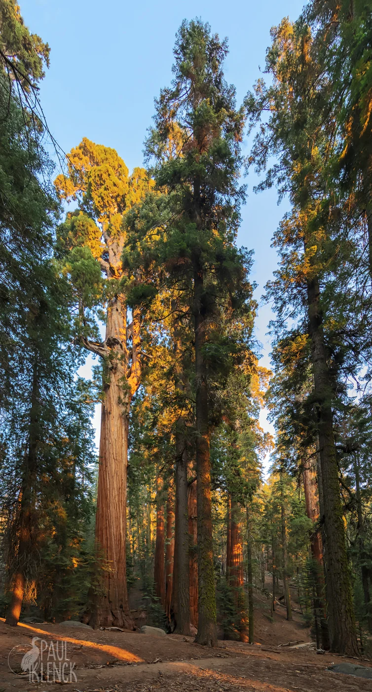
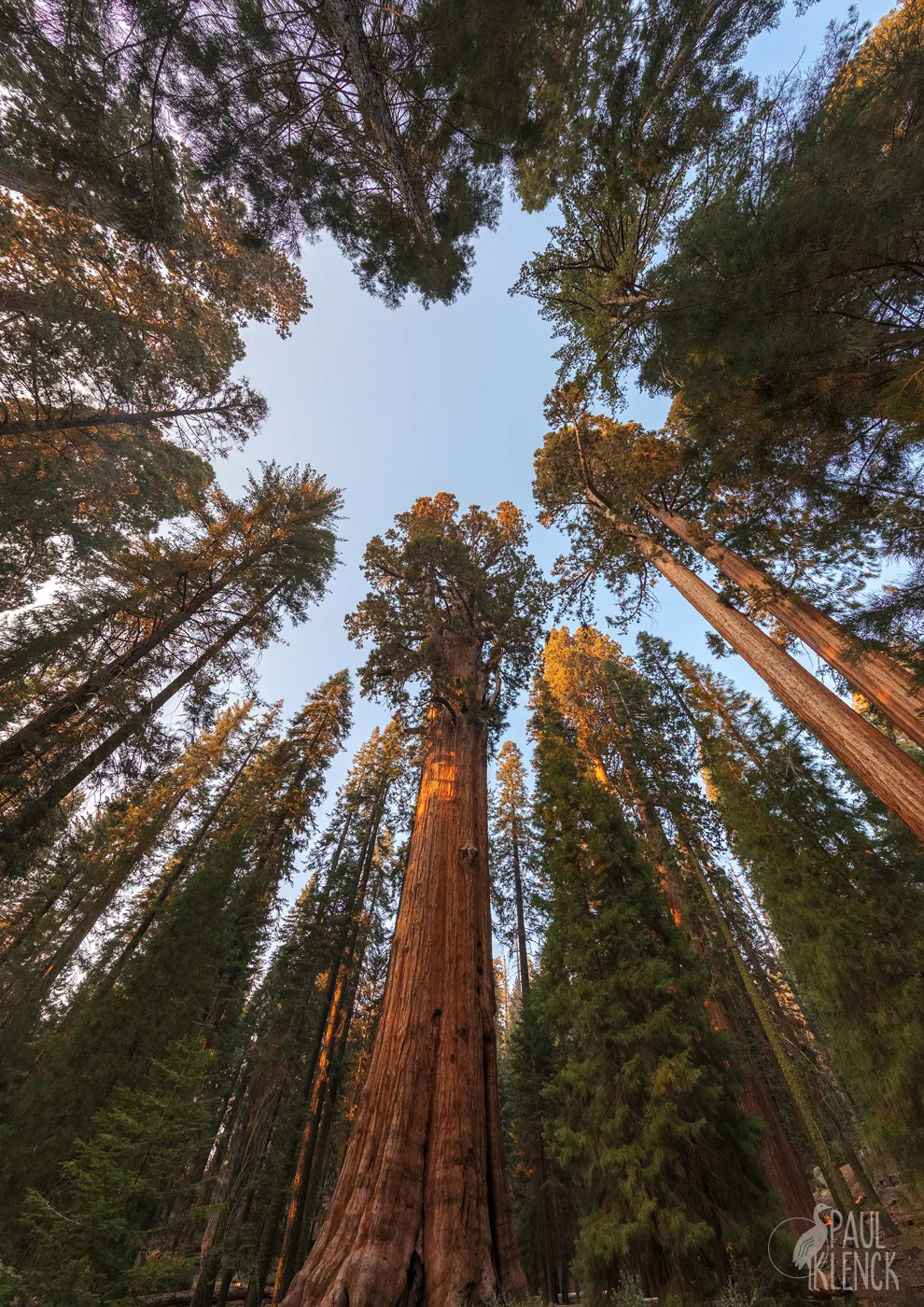
On the shoulders of the Sierra Nevada Mountains grow sequoia trees, the largest living things. On the coast grow their cousins, the redwood. So while not the correct species, I think Van Morrison’s song works.

Family under The General Sherman

Family under The General Sherman

Boy and his dog
Went out looking for the rainbow
You know what did they learn
Since that very day

Walking by the river
And running like a blue streak
Through the fields of streams and meadows
Laughing all the way

The Congress Trail, Sequoia National Park

The Congress Trail, Sequoia National Park

Oh redwood tree
Please let us under
When we were young we used to go
Under the redwood tree

Tree halo

Tree halo

And it smells like rain
Maybe even thunder
Won't you keep us from all harm
Wonderful redwood tree

Sequoia sunset

Sequoia sunset

And a boy and his father
Went out, went out looking for the lost dog
You know what oh haven't they learned
Since they did that together
They did not bring him back
He already had departed
But look at everything they have learned
Since that, since that very day

Van Morrison, Redwood Tree, 1972

The Florida Mountains

I’ve mentioned before that one of my mentors growing up in Florida was Erna Nixon. I don’t remember the context, if she was commenting on a picture I showed or we were just outside looking and talking, but she remarked that in Florida, clouds are our mountains. Hope you like the mountain views.

Sunrise storm, Melbourne Beach, Florida

Sunrise storm, Melbourne Beach, Florida

Wood Stork, Merritt Island National Wildlife Refuge

Wood Stork, Merritt Island National Wildlife Refuge

Moccasin Island Tract, River Lakes Conservation Area, Florida

Moccasin Island Tract, River Lakes Conservation Area, Florida

Seeing 10 million years

You may have noticed a new watermark on my images. My son Dan and his fiancee Melina gifted me with this graphic designed by a friend of theirs, Hannah Bess Ross. Many Native American cultures have totems or tonalii which are spiritual links to an animal. My link is to this tall, ancient bird.

Sandhill Crane, Virgil Grissom Wetlands, Florida

Sandhill Crane, Virgil Grissom Wetlands, Florida

This fellow, nearly five feet tall, let me sit in the grass and watch him dig for insects while getting his portrait with a wide angle lens. Sandhills in Florida become accustom to humans and have even eaten out of my hand. While some Sandhills live year round in Florida, most migrate to the northern U.S. and Canada. An eastern migration route spends several weeks south of Lake Michigan in Jasper Pulsaki Wildlife Refuge in northern Indiana feeding on leftovers in the surrounding farm fields.

Corny landing

Corny landing

Fossils of birds nearly identical to the Sandhill are over 10 million years old. The Sandhills’ call is loud, ancient, and unforgettable. Click here for their flight call Our home is on the migration path, and I’ve heard their call in my house and gone outside to see hundreds of cranes far up in the sky on the move.

The birds mate for life, and you can find pairs doing elaborate dances jumping in the air, spreading their wings, and calling to their mate.

Moondance

Moondance

Jasper Pulaski sunset flight

Jasper Pulaski sunset flight

The western migration route funnels the cranes along the Platte River in Nebraska, and many winter along the Rio Grande in New Mexico or head further south into Mexico. The cranes usually spend the night in water to keep away from predators. At Bosque, near dawn, thousands of cranes and geese explode in flight from the pools and fly to nearby fields. Last week’s post had an image of snow geese on a dawn take off.

Cranepool, Bosque del Apache National Wildlife Refuge, New Mexico

Cranepool, Bosque del Apache National Wildlife Refuge, New Mexico

Sandhill Trio

Sandhill Trio

Sandhill reflection 2-26 web.jpg

The fellow in the first image let me collect some close up shots along with the wide angle.

Close up time

Close up time

Silent Night

All is calm, all is bright

Salmon River, Idaho

Salmon River, Idaho

Glories stream from heaven afar

Dawn, Wyoming

Dawn, Wyoming

Love'‘s pure light

White Sands, New Mexico

White Sands, New Mexico

With the dawn of redeeming grace.

Bosque del Apache, New Mexico

Bosque del Apache, New Mexico

Kodachrome

Utah is filled with spectacular national parks and monuments, and it has some state park gems. With appropriate marketing, one is named Kodachrome Basin State Park.

Sunset, Kodachrome Basin State Park, Utah

Sunset, Kodachrome Basin State Park, Utah

How about a quiz? What does this image have to do with the next one?

Morning Glory Spring, Yellowstone National Park, Wyoming

Morning Glory Spring, Yellowstone National Park, Wyoming

Sedimentary pipe

Sedimentary pipe

While geologists aren’t sure how the 67 sedimentary pipes in the park were formed, the primary theory is that they are remnants of ancient springs, like Morning Glory above, that were then filled with sediment and the softer sandstone eroded away. The monoliths are intriguing features throughout the park.

Fins and spires, Kodachrome Basin

Fins and spires, Kodachrome Basin

Moon and Venus, Kodachrome Basin State Park

Moon and Venus, Kodachrome Basin State Park

Grand Sunset

As I was photographing in southern Utah, I had worked my way east and crossed into northern Arizona. I was getting ready to retrace my path back to the hotel, when I noticed clouds gathering in the south. I took a chance that a return route via the north rim of the Grand Canyon might yield a nice sunset. I checked to make sure the road was open and headed out. As I drove, smoke gathered, and I was soon driving through the darkness of a prescribed forest burn. Photography wasn’t looking too good. I got through the burn and the clouds were still up, but a mist was gathering. I took a chance there would still be a colorful sunset and drove to the canyon.

There are fewer visitors to the north rim, and I discovered very few on the cold, mid-November evening. I was joined by a few photographers and viewers, but a mist was obscuring the view, and the sky was slate gray.

Bright Angel Point, Grand Canyon National Park

Bright Angel Point, Grand Canyon National Park

Two guys were scouting the run they would make the next day. To the South Rim and back!! Fourteen miles and nearly 6,000 feet down, then over twelve miles and 5,000 feet up, and then come back. Unbelievable.

I was content to stay on the rim and take some images. The conditions were improving.

View from the North Rim of the Grand Canyon

View from the North Rim of the Grand Canyon

The winter sun hit the southwest rim. Most everyone had left the cold night except for one other photographer and his French Bulldog who had a great deal of interest in my shoes—and likely my friend’s bulldog I had visited a few days before!

Sunset, Grand Canyon

Sunset, Grand Canyon

Then, a sight I’d never seen before. The sun seemed to melt, dissolve and whirl away.

Whirling Sun

Whirling Sun

By now, I was alone on the rim. But the light show often doesn’t end after the sun sets. After the drama, a simple coda. And then perhaps, some stars.

Grand Canyon dusk

Grand Canyon dusk

Southwest Night Sky

One of the great attributes of the Southwest U.S. away from the cities is the dark skies. A benefit of traveling at the end of the year is that it is darker longer. Our first night in Death Valley National Park had clear, desert sky, an early setting moon, and a Night Sky ranger talk. After the talk, another couple sat outside their car enjoying the Milky Way.

Milky Way, Death Valley National Park, California

Milky Way, Death Valley National Park, California

As the week went on, the moon got fuller and stayed up later making it more difficult to get the darkest sky images. However, the moonlight helped light up the red rocks of Zion National Park. The first image below is looking west with the Milky Way starting to appear. The next image is turned east with the moon and Venus showing through the remaining light from the setting sun.

Mt. Carmel Highway, Zion National Park, Utah

Mt. Carmel Highway, Zion National Park, Utah

Southeast view, Zion National Park

Southeast view, Zion National Park

A future blog post will have some images from one of the most amazing sunsets I’ve ever seen. Afterward, some stars started coming out. You can see the constellation Cassiopeia over the tree on the left. You want clouds for a fiery sunset, but not for star images.

North Rim night, Grand Canyon National Park, Arizona

North Rim night, Grand Canyon National Park, Arizona

The moonlight helps light the hoodoos of Bryce Canyon.

Bryce Canyon National Park, Utah

Bryce Canyon National Park, Utah

Just outside Bryce National Park is Red Canyon in Dixie National Forest. Your eyes’ night vision don’t pick up color very well, but the camera sensor captures the red rock in the moonlight.

Red Canyon, Dixie National Forest, Utah

Red Canyon, Dixie National Forest, Utah

Into the valley of death

Badwater Basin, the lowest point in North America, lies 282 feet below sea level. A spring-fed pool sits in the salt of the basin, reflecting the Black Mountain range to the east.

Badwater Basin spring, Death Valley National Park

Badwater Basin spring, Death Valley National Park

A walk from the spring into the salt flats challenges perspective. A small landmark looks not far away, until you’ve walked a half mile to get there.

Salt flats and Panamint Range, Death Valley, California

Salt flats and Panamint Range, Death Valley, California

Death Valley is also the driest location in the U.S. Less than 2 inches of rain fall in an average year, though the evaporation is so great, a 12 foot deep lake would evaporate in that year. The evaporation over eons has left a great salt pan across the valley. The salt forms great fractal patterns across the Basin.

Badwater Basin salt fractals and Black Mountains

Badwater Basin salt fractals and Black Mountains

At Dante’s View in the Black Mountains, you can look nearly a mile down into the Basin and across the Valley. On a very clear day Mt. Whitney, the tallest peak in the contiguous States at over 14,000 feet, is visible.

In the picture below, you can see Badwater Basin road. The spring in the first image, is blocked from view by the ridge. The second image was shot on the portion of the trail showing just above the ridge that is darkened by footsteps and was in the shadow of the Black Mountains when taken. The third image was taken in the bright salt flats where the trail ends. If you look very carefully, you might be able to see a few hikers there, a mile out from the spring.

Badwater Basin from Dante’s View

Badwater Basin from Dante’s View

Toadstools on the Staircase

Established in 1996, Grand Staircase-Escalante National Monument spreads across southern Utah. President Trump has attempted to reduce protected land by nearly half, and open 700,00 acres to mineral extraction. Neighboring Bears Ears National Monument, established primarily to protect Native American antiquities, was reduced even more. The executive actions are still pending court review.

A short hike leads to a collection of “toadstools,” pillars supporting a harder boulder. The column is sheltered by the boulder and erodes more slowly than the surrounding rock.

Toadstool Formation, Grand Staircase-Escalante National Monument, Utah

Toadstool Formation, Grand Staircase-Escalante National Monument, Utah

In the upper center of this image you can see the younger, harder Dakota Formation boulders above the softer, older Entrada Sandstone. One Dakota boulder rests on a forming toadstool in the center.

Kane County, Utah

Kane County, Utah

Sometimes it’s helpful to have some human scale to better appreciate the formations.

Paul Klenck and Toadstools-8748a web.jpg

Jets and contrails criss-cross the sky. Hopefully, these toadstools will withstand encroachment from the ground.

Toadstools-silhoute web 0312.jpg

Pink Sands

I’m out collecting some images in southern Utah. Yesterday morning I couldn’t resist the name of Coral Pink Sand Dunes State Park right on the Arizona border.

Coral Pink Sand Dunes State Park, Utah

Coral Pink Sand Dunes State Park, Utah

The park is used extensively by ATVs and other vehicles in the dunes, so finding areas without tracks can be a challenge.

Coral Pink Sand Dunes (1 of 1)-7.jpg

Below your feet are lots of little animal tracks among the vehicle track and footprints, and many unusual plants grow. I think I brought a good portion of the sand back in my shoes.

Coral Pink Sand Dunes (1 of 1)-2.jpg

Autumn entered

Fall colors came running in and quickly out of northern Illinois. Nice colors this year. Here are some yellows.

Morton Arboretum, Lisle, Illinois

Morton Arboretum, Lisle, Illinois

Under the Maple tree

Under the Maple tree

Yellow explosion I

Yellow explosion I

Just be careful where you park.

Yellow explosion II

Yellow explosion II

What's flowing in Transylvania?

Transylvania County is the wettest in North Carolina and has over 250 waterfalls. Here’s what’s likely the best known. Looking Glass Falls is next to the main road running through Pisgah National Forest heading to the Blue Ridge Parkway and is a popular stopping point.

Looking Glass Falls, Pisgah National Forest, North Carolina

Looking Glass Falls, Pisgah National Forest, North Carolina

Looking downstream from the falls.

Looking Glass Creek, Pisgah National Forest

Looking Glass Creek, Pisgah National Forest

I went looking for another tall falls that 40 years ago I hiked to with my buddies and jumped off the top to swim in the pool below. I couldn’t find it, but I heard some falls along the trail and found this delight.

Chestnut Falls, Pisgah National Forest

Chestnut Falls, Pisgah National Forest

The Eastern Band of the Cherokees Reservation sits between Transylvania County and Great Smoky Mountains National Park, and is also filled with waterfalls. Here are two—or three, if you count the first as a double falls.

Soco Falls, Cherokee Reservation, NC

Soco Falls, Cherokee Reservation, NC

Mingo Falls, Qualla Boundary, North Carolina

Mingo Falls, Qualla Boundary, North Carolina

Weathered feathers

Birds need to eat, raise young, survive regardless of the weather. Fortunately, for a photographer, challenging weather can make engaging images. I love the challenge of wide angle environmental images, but to get an animal portrait, you need a tolerant creature. This Great Blue Heron, who hangs around people fishing on the beach, was cooperative.

Melbourne Beach storm clouds

Melbourne Beach storm clouds

Great Blue Heron dawn

Great Blue Heron dawn

Turkey Vultures have an image problem. Their life cleaning up dead animals adds to the creepy view. Featherless heads and legs to get into the carrion enhance the feel. A telephoto lens helps get a closer view.

Turkey Vulture, Canaveral National Seashore

Turkey Vulture, Canaveral National Seashore

Crossing the talons is a cute gesture, but note the missing middle toe and wonder what happened to this survivor.

20150131_Canaveral 118 vulture toes web.jpg

But vultures should have their day in the sun, or in this case, in a rainbow.

Somewhere under the rainbow

Somewhere under the rainbow

As sweet as Tupelo Honey

Congaree National Park in central South Carolina is the largest remnant of old growth floodplain forest in the U.S.. Less than one-half of one percent of what once was 35 million acres in the Southeast U.S. remains.

You can take all the tea in China
Put it in a big brown bag for me

Tupelo trees, Cedar Creek, Congaree National Park

Tupelo trees, Cedar Creek, Congaree National Park

Along with Tupelo, Bald Cypress grows throughout the floodplain. The knees are still a mystery. Perhaps support in flood conditions, perhaps an air exchange.

She's as sweet as Tupelo honey
She's an angel of the first degree

Bald Cypress knees

Bald Cypress knees

The Congaree was a shelter for runaway slaves during the Civil War. After the war, many former slaves farmed the floodplains and established towns in the uplands.

You can't stop us on the road to freedom
You can't keep us 'cause our eyes can see

Tupelo and Cypress

Tupelo and Cypress

I’ve never gotten more aerobic exercise on a flat trail. Despite covering myself in insect repellent, whenever I’d stop walking, a cloud of mosquitoes would surround me, so moving fast was the best repellent. However, the fast pace had me miss seeing the 5 foot coachwhip snake, and we gave each other a good fright. My heart rate got another boost startling two feral hogs in underbrush. It was a memorable hike.

Boardwalk trail among the Tupelo

Boardwalk trail among the Tupelo

She's as sweet as Tupelo honey
Just like honey, baby, from the bee

Van Morrison

Bald Cypress, Congaree National Park, South Carolina

Bald Cypress, Congaree National Park, South Carolina

Graveyard Fields

Until I returned, I’d forgotten I’d left a piece of my soul here. A stop on the Blue Ridge Parkway looks down into an area called Graveyard Fields. the area had a geologic event that killed the trees and left stumps and mounds leaving it look like a graveyard. A devastating fire in the 1920s reinforced the look. When I worked at a nearby summer camp, I’d lead hikes into this area. We’d sometimes camp in the fields and could watch shooting stars while sleeping under the open sky. Camping is now prohibited here, and trees and larger growth have replaced the open field.

Graveyard Fields trail, Pisgah National Forest, North Carolina

Graveyard Fields trail, Pisgah National Forest, North Carolina

Part of the trail runs along the Yellowstone Prong of the Pigeon River. I had a college roommate who lived nearby in North Carolina. He returned home for a long weekend while I was in law school, and I went with him so I could hike again along the Pigeon River. It started raining just as I got my tent up. It rained all night. Before it was light I heard strange sounds and looked out and the river was flooding and approaching my tent. I hurriedly broke camp and bushwhacked my way to the pick up point since most of the trail was flooded. This was my first time back.

Yellowstone Prong, Pigeon River

Yellowstone Prong, Pigeon River

There are waterfalls nearly everywhere you hike, including these lower falls of the Yellowstone Prong in Graveyard Fields.

Second Falls, Graveyard Fields, North Carolina

Second Falls, Graveyard Fields, North Carolina

An overlook on the Parkway provides a distant view of the falls.

Yellowstone Prong falls

Yellowstone Prong falls

Near where we’d camp, there were several several branches of the trail, and I wasn’t sure which was the main trail. I followed one to these rocks on a bend in the river. I was suddenly taken back 40 years. I’d bring the young campers to this very spot to swim and play. I hadn’t thought of it in all that time, and the memory opened as I placed my feet on the spot.

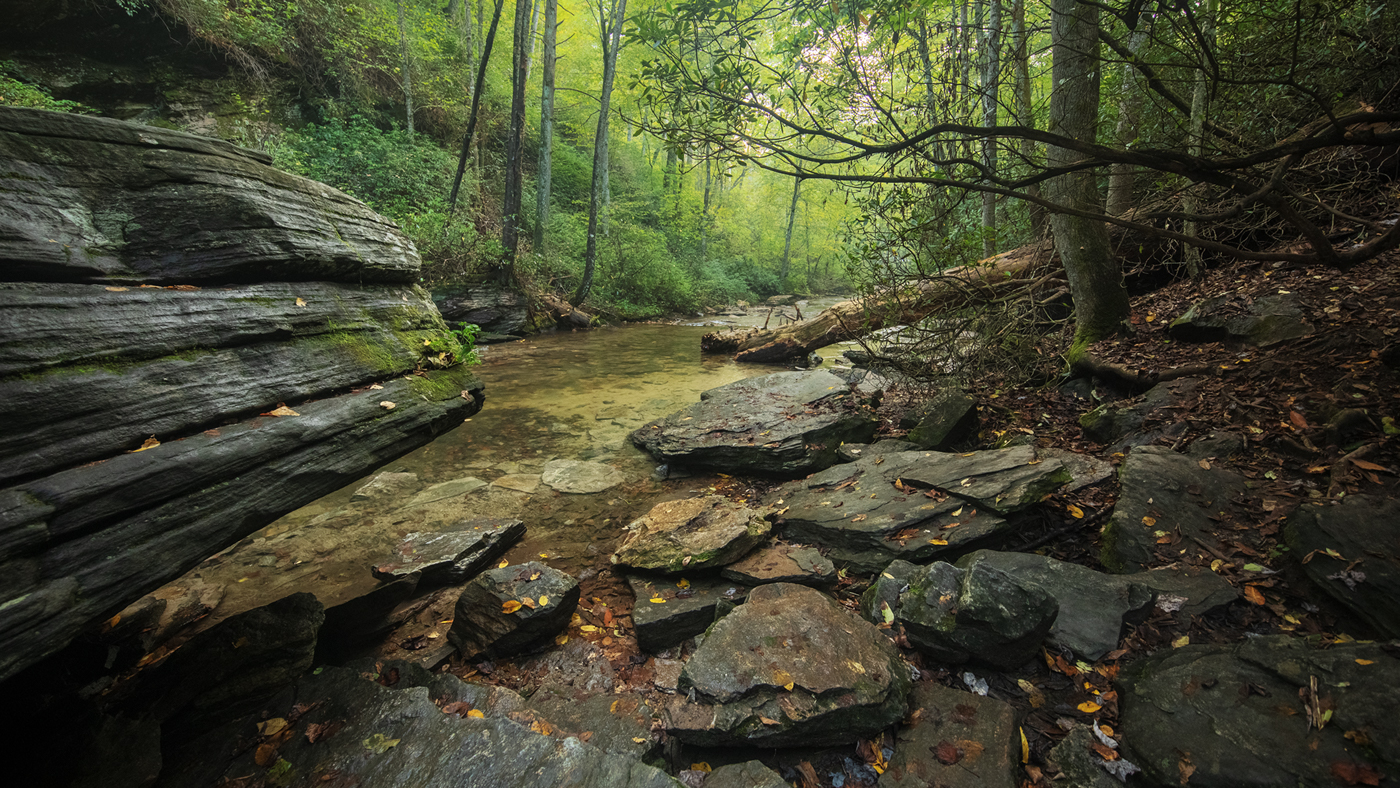
Swimming hole, Yellowstone Prong, Pisgah National Forest

Swimming hole, Yellowstone Prong, Pisgah National Forest

Memory catcher

Memory catcher