Temples of Sun, Moon & Stars

After leaving San Rafael Reef and the Factory Butte area, I headed up a favorite backroad I’d ridden twice before on the east side of Capitol Reef National Park. So why are there reefs in the middle of the desert? As pioneers traveled, the long folds in the planet’s crust were impossible to go over and difficult to get around. They recalled coral reefs that impeded ship travel. Here, the nearby white domes of Navajo Sandstone led the Mormon settlers to think of the new dome in the national capitol, and so it was named Capitol Reef.

Cottonwood in the Fremont River Canyon, Capitol Reef National Park, Utah

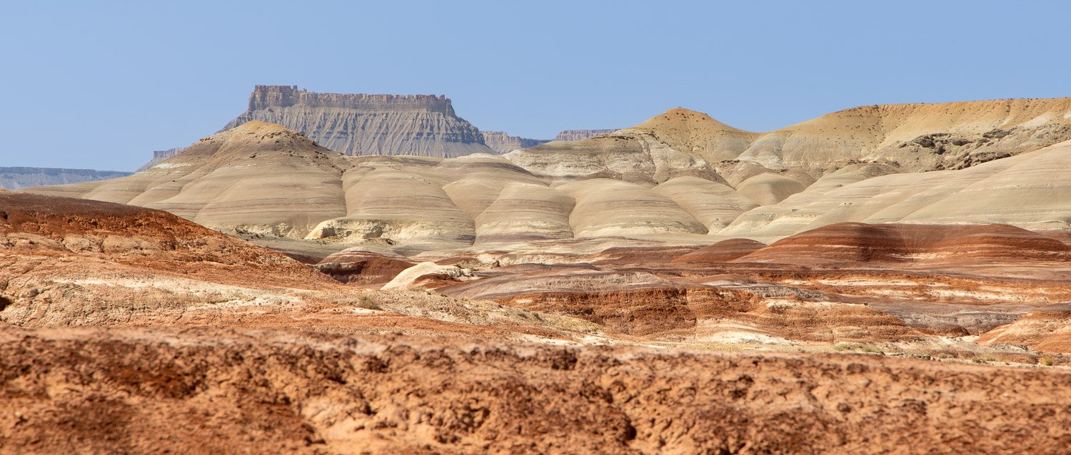
Capitol Reef is part of the 100 mile Waterpocket Fold, and the long, narrow park runs along this geologic feature. Cathedral Valley is a remote section in the northeast part of the park filled with monolithic features that rise out of the desert floor like gothic cathedrals. Two of these are named Temple of the Sun and Temple of the Moon. As I planned the trip, I was not thinking of going this far west or returning to this park. However, as I studied the calendar, I saw I’d be near these features around the time of the new moon—the darkest nights in one of the darkest places. The temples could be dramatic foreground elements for photos. I’d just need clear skies. Write it in the itinerary and hope for the best.

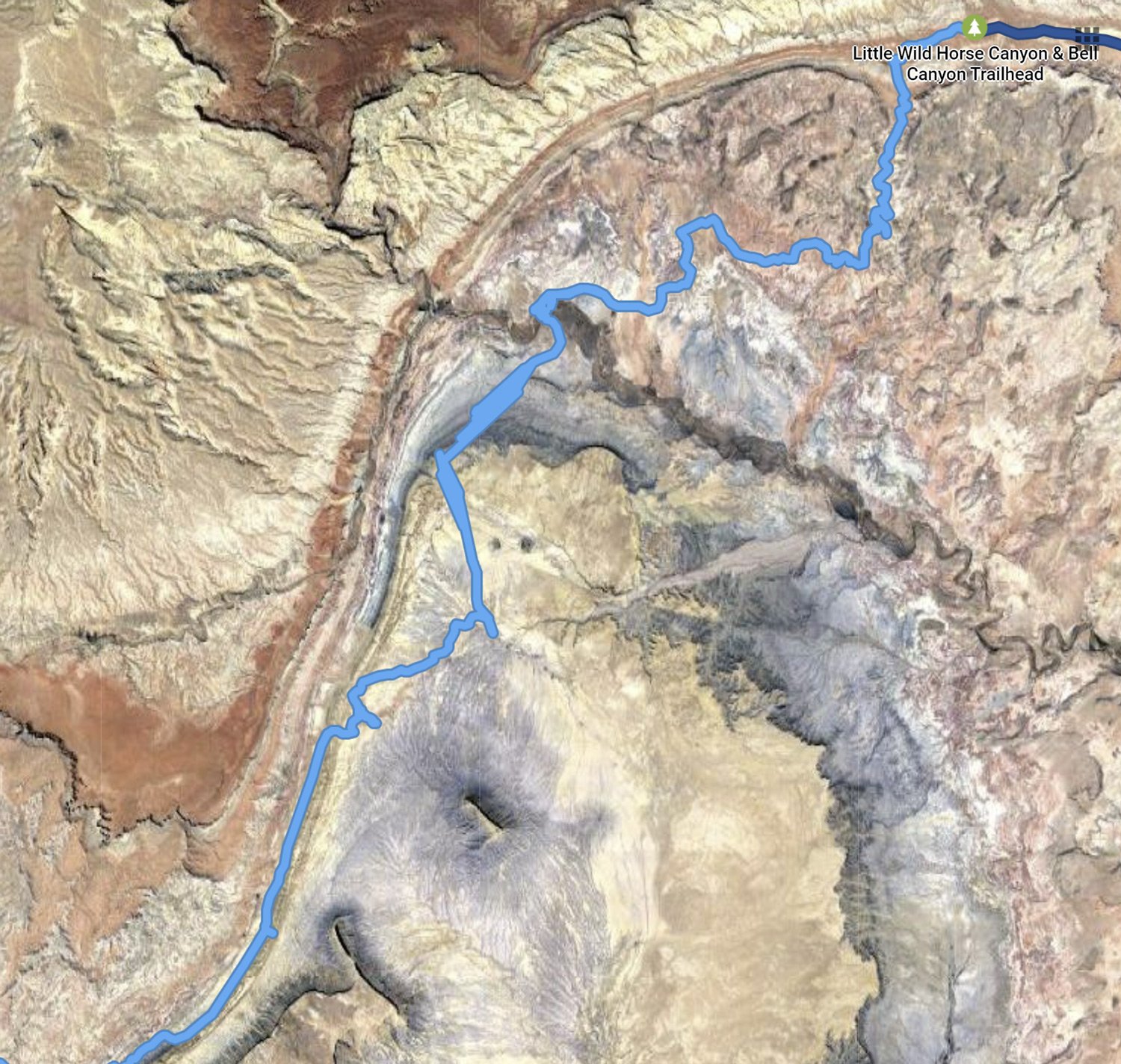
You can only camp in designated campgrounds in national parks. However, Cathedral Valley Road runs mostly on Bureau of Land Management property next to Capitol Reef, and boondocking on BLM land is usually no problem. I figured I could find a camping spot near Temple of the Sun, and bingo, right outside the park boundary was a nice site for the night. In the Google Map below, Park land is in tan, and my camp was on the white BLM land a mile from Temple of the Sun.

After finding camp and making dinner, Chance and I explored around the two monoliths looking for potential spots to find in the dark. The blue sky held promise for clear night skies. The dreams I’d planned were clicking into place.

Temple of the Sun, Capitol Reef

After some good sleep in the cool desert night, it was time. The clouds had stayed away. The Milky Way arced across the sky. Constellations beamed down. Even on a moonless night, stars alone provided an amazing amount of light. And the sight was wonderous.

Temple of the Sun

Chance laid by the car while I walked around Temple of the Sun, hoping Scorpio stayed in southern sky and didn’t send any relatives to the ground. An occasional shooting star seemed to provide music in the silence. Time to take a short drive over Temple of the Moon and capture some image there. Very soon, some faint light started glowing on the horizon. A few misty clouds began forming.

Temple of the Moon

Just ten days before I’d proclaimed one of my favorite verses at the Easter vigil:

And so it happened:

God made the two great lights, the greater one to govern the day, and the lesser one to govern the night; and God made the stars.

God set them in the dome of the sky, to shed light upon the earth, to govern the day and the night, and to separate the light from the darkness.

God saw how good it was.

As the stars began to fade, it was time to get back on Cathedral Valley Road and head toward the highway. There were still plenty of stops to enjoy the morning light and watch the park features waking up.

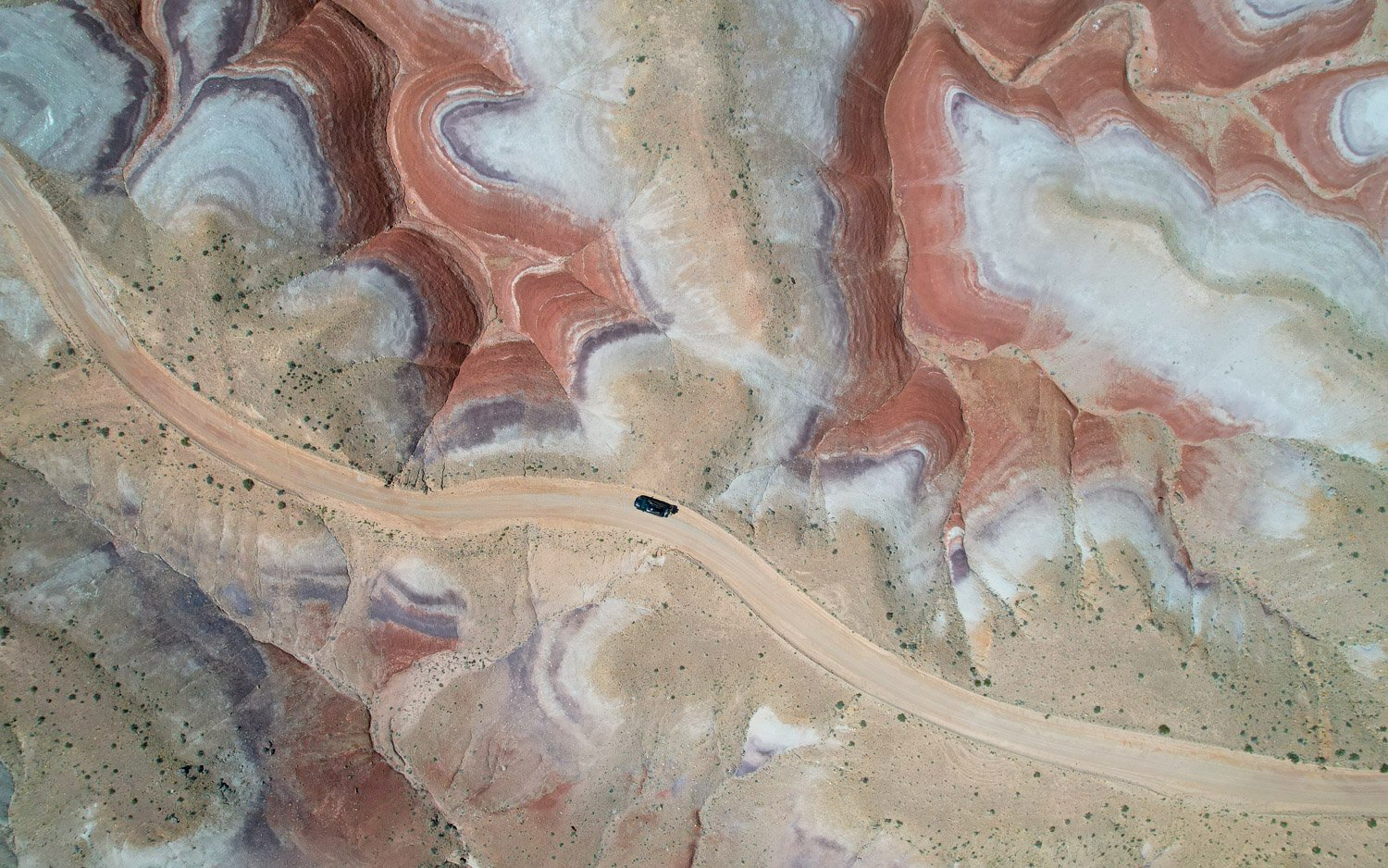
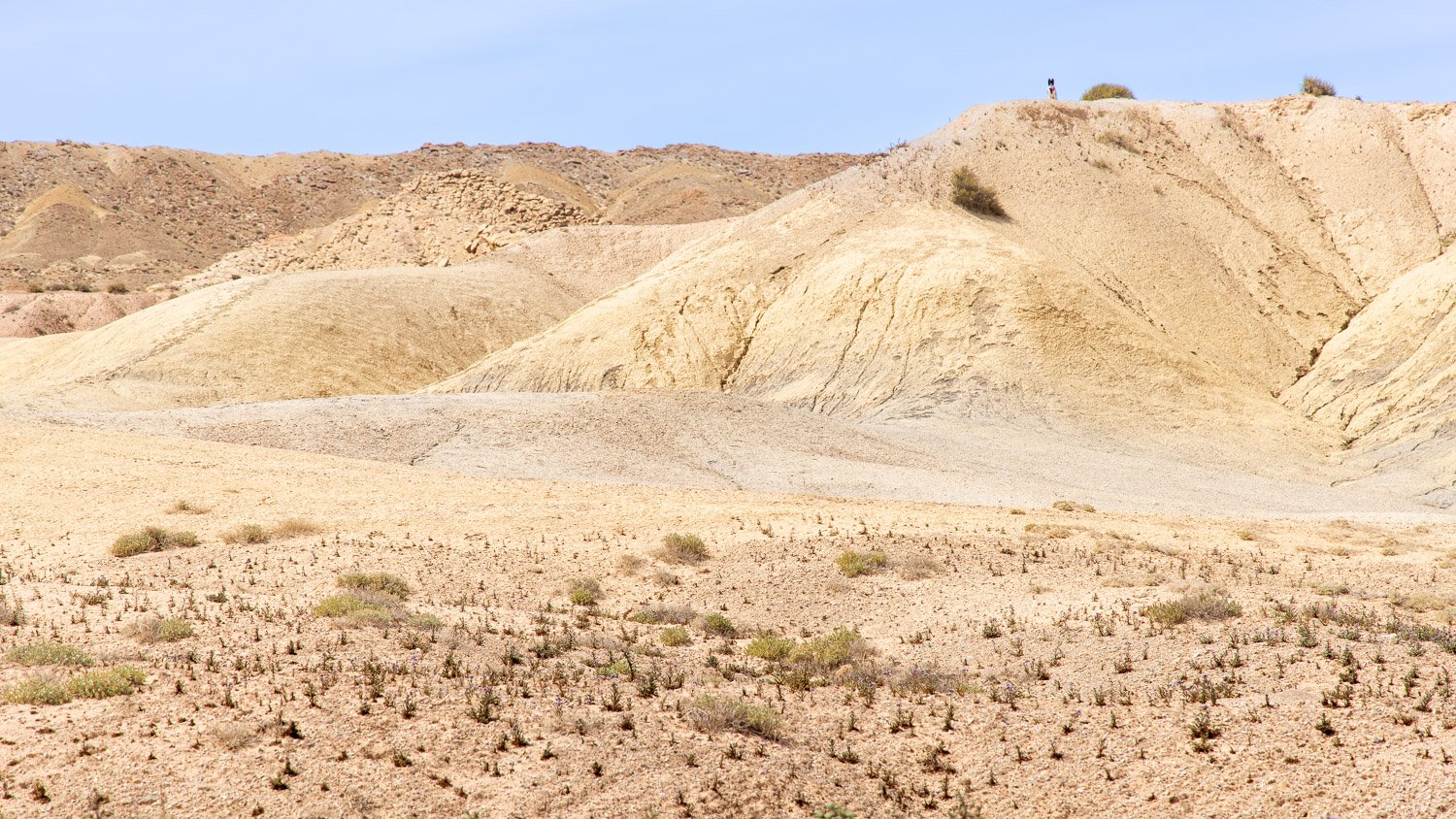
The road climbed over Bentonite hills before getting to the highway. Some of the Native Americans called this area “Sleeping Rainbow.” As the sun was reaching the horizon, the cloud cover increased. Time for breakfast. The clear skies, the night, and the stars were gone. And it was very good.

Wilderness & Factory along the San Rafael Swell

Last week I posted about some features on the northeast area of the San Rafael Swell. The paved road ended by Little Wild Horse Canyon and a very rough road continues along the reef edge of the swell and into the wilderness. In 2019 the Muddy Creek and the Middle Wild Horse Mesa Wilderness areas were created by Congress and are managed by the Bureau of Land Management. Generally, no motorized vehicles are permitted in places designated as wilderness areas. However, exceptions were made for the existing primitive roads that snake through these lands.

Google Timeline - Little Wild Horse Canyon to North Caineville Mesa

The Google Timeline satellite map shows my route from Little Wild Horse Canyon at the top, then paralleling the reef line of the San Rafael Swell, crossing Muddy Creek—the brown river winding across the middle, past Factory Butte, and exiting out near North Caineville Mesa on the bottom. The Wilderness Areas are roughly in the north half of the image.

Ding Dang Dome and San Rafael Swell reef

Near the beginning of the road was a sign for two slot canyon trails that require canyoneering skills to enter. These are named Ding and Dang Canyons and cut into the reef that is seen in the background of this image. Rising off the desert floor is what looks like a pyramid. The feature is named Ding Dang Dome. One of the very few trees seen on the entire route rises out of a wash.

Badlands and Factory Butte

Soon you’re winding into colorful badlands and Bentonite Hills. Dominating the landscape for many miles is Factory Butte. In the Google map you can see it isolated in the lower left corner. Mormon pioneers travelling through the area thought the feature resembled a large cotton mill factory. As the road rose up into the Bentonite Hills, I stopped to get out my new camera and fly it up for a different view.

Bentonite Hills

The Bentonite Hills continue on and off to the west toward Capitol Reef National Park. The colorful Bentonite was formed of mud, silt, sand and volcanic ash deposited in swamps and lakes in the Jurassic Period. The features are fragile and the surface is like popcorn. You don’t want to drive through these hills after a rain when they become an impassible, sticky mess.

Much of the road is relatively smooth and easy to follow, but you can suddenly come across rough rock and gullies and branches that you need to guess which is the right route. A 4WD vehicle with high clearance is necessary in several parts. I got completely confused when the road crossed through Muddy Creek. The car did fine crossing the water, but I kept going in circles. Finally, I realized getting a view from the drone would help me figure out the correct path. It worked! But I forgot to take pictures of the crossings. Later looking at the Google Timeline map helped me see how I was getting turned around by the river crossings.

Soon we were driving out of the wilderness areas and a sign facing the other way identified the area we’d gone through. It was the only one we saw on the drive after the signposts for Ding and Dang. The reef of the San Rafael Swell rises over the scene. The colorful badlands receded behind us while ahead gray and tan, barren sands stretched toward Factory Butte rising to 6,300 feet above the desert floor.

Chance was not in the mood for hiking this day, so when I parked and started hiking through the ridges toward the butte, he found a high point to sit and watch me. I got about a third of a mile away, and could see his silhouette sitting on the point keeping watch.

Time to get the drone back up for a view of the butte and the combs and ridges falling away from it. The expansive area covering much of southeast Utah, southwest Colorado and into northern Arizona and New Mexico is the Colorado Plateau filled with incredibly diverse geologic features.

The combs of Factory Butte and the Henry Mountains behind

This area is outside the wilderness designation, so off-road vehicles are permitted to explore. You might see some of their tracks if you look carefully at this view straight down into the ridges.

We made one last stop for a view of Factory Butte near North Caineville Butte. A trail heads up the other side of North Caineville Butte, and I considered hiking up it a couple days later since it promised a great view. But I decided that hike would have to wait for another trip. As for this day, we next headed into a remote part of Capitol Reef National Park, and camped near a feature called Temple of the Sun where I hoped to get some night sky images. Hopefully, I’ll share those next week.

North Caineville Butte with Factory Butte behind