One place I had to visit on my trip to the Four Corners was Shiprock in northwest New Mexico. It had resided in my imagination for decades. I’d seen many images. It had been in several books—including the Joe Leaphorn/Jim Chee series by Tony Hillerman. (There’s an excellent adaptation on AMC right now called Dark Winds.)
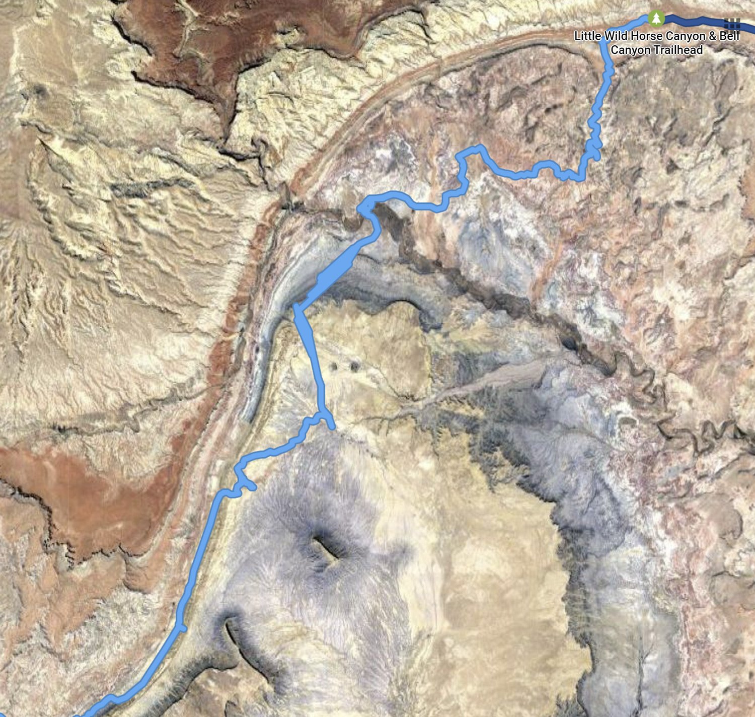
The ancient volcanic plug is a holy site for the Navajo. I first saw it probably 50 miles away as a ghost on the horizon when I camped in Colorado at Hovenweep National Monument, and wrote about the view that day. When I eventually drove to it, there was a long route that would get me closer, but I chose a shorter, dirt roadway by GPS. I passed many reservation residences and hogans. Eventually, the route came to a wash that I was not willing to try to get across. So I settled for a more distant view.

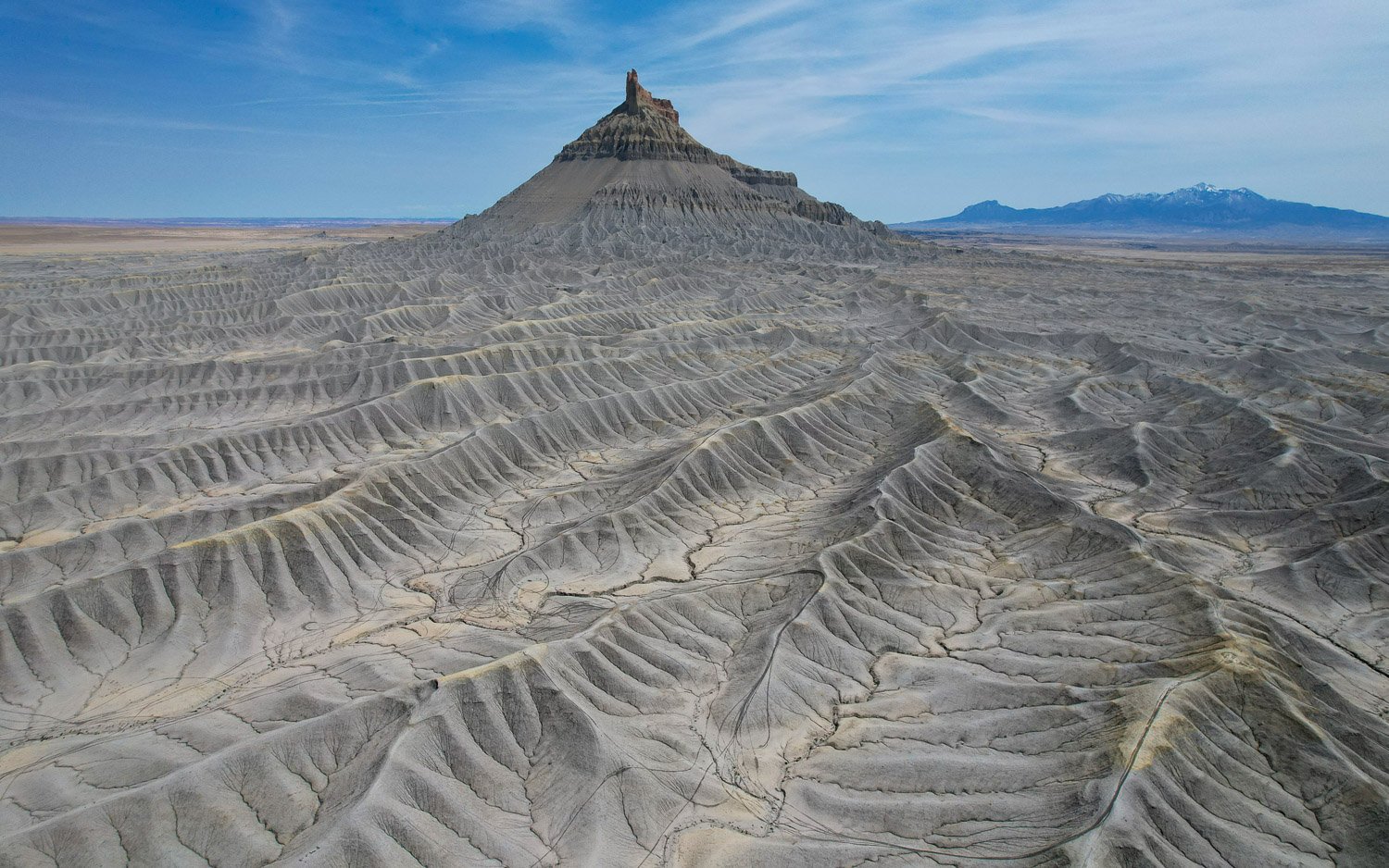
Shiprock from drone
I first heard of Shiprock through the stories of Murray Bodo, OFM. He was a high school English teacher in Cincinnati of my friend and college roommate. I had the pleasure to meet him several times. As the Navajo find sacredness in the presence of Shiprock, so I found it in his presence. Fr. Bodo follows the tradition of his order’s founder and is an extraordinary poet and writer.
From the Lukachukai Mountains you can see the land. The desert stretches below you on all four sides and to the north Shiprock stands at anchor in the still brown sea. When I was a boy, my father and his fishing buddies and I would speed past Shiprock almost every weekend on our way to the cool Colorado trout streams. I had never seen the ocean or a sailing vessel, so Shiprock became my frigate on the high seas and I would fire a volley past her bow from the back seat of our Chevy while my father and his friends talked of fishing.
When we returned to Gallup every Sunday night, I would wait excitedly for Shiprock to come into view once again. I would adjust my spyglass and scan the emptiness for her. And then she would suddenly emerge like a submarine surfacing on the horizon. I would prepare the men for the attack and caution them to wait until we were as close as possible before we commenced firing. It was great fun always, and Shiprock became my private pirate ship on countless voyages across dry, waveless seas of sand.
Murray Bobo, OFM, Walk in Beauty, 1974
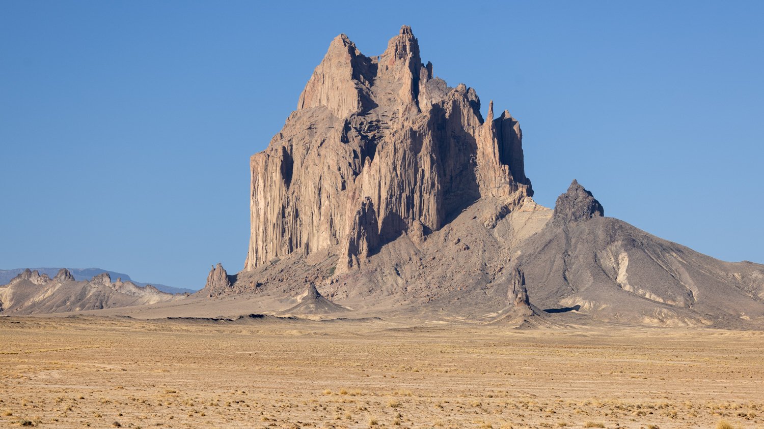
Shiprock, Navajo Nation
Today, as I drive slowly, meditatively on Route 666, looking at Shiprock, I realize my whole life has been a movement away from and, paradoxically, toward this rock that rises out of the desert like the ship that it’s named for. It sails fixed in place and time, the water now turned to desert sand. It endures, anchored where I find it over and again on the interminable voyages I take to and from the mother ship. Our origins are like that. We leave them and travel in ever-widening circles away from them. They continue to hold us in their circumference like the hub of the wheel we spin circles around. We break the circle from time to time and turn, return, to the hub that is there unchanged though we have changed and continue to change.
Murray Bodo, OFM, The Road to Mt. Subasio, 2011
About the time that book was published, Fr. Bodo spoke nearby, and I got to see and hear him again, and simply be in the presence of a holy man. If of interest, you can find his works here: MurrayBodo.com

Murray Bodo, OFM