Tettegouche State Park

Minnesota’s North Shore of Lake Superior is a necklace of wonders, and one of the gems is Tettegouche State Park. The southwest edge of the park is the Baptism River flowing into the lake. The Lake is at a record high level. When I was last there about 15 years ago, I hiked well out into this bay to the cliff on the other side of the river. In the far distance you can see the feature called Shovel Point where we’ll hike to.

Baptism River, Tettegouche State Park, Minnesota

Baptism River, Tettegouche State Park, Minnesota

A lovely trail takes you through the birch, spruce, fir, pine and maple forest over to Shovel Point.

trail_7841.jpg
trail_7811.jpg

Parts of the trail open up to views of Lake Superior, or Gichigami in the Ojibway language. The local Indians called themselves Gichigamiwininiwag.

Lake spruce_7541.jpg

The lava flows that helped create the features of the shore expose some of the oldest granite on earth. Here’s a view further northeast from Shovel Point, and then a view back southwest toward the Baptism River where we started. Hope you enjoyed the hike!

north view_7516.jpg
Lake Superior View from Shovel Point

Lake Superior View from Shovel Point

Livingston Storm, I presume

I just read that the two flattest states are Florida and Illinois, which have been my homes my entire life. That doesn’t lead to dramatic landscapes, so thankfully both have great clouds. For Illinois, the most dramatic are this time of year as humidity fills the air and storms role across what had once been prairie and is now mostly corn or soybean farmland.

Sheets of rain, Livingston County, Illinois

Sheets of rain, Livingston County, Illinois

Farmhouse and soybeans under the darkening sky

Farmhouse and soybeans under the darkening sky

Livingston County in north central Illinois produced the third largest soybean crop in the state at nearly 17 million bushels, and the second largest corn crop at 63 million bushels. It has two of the state’s largest prisons—Pontiac for men and Dwight for women. Central Illinois was also ground zero of the founding of the Republican Party, and since 1856 a majority has only voted for one Democratic candidate—Franklin Roosevelt in 1932.

Livingston County corn

Livingston County corn

The biggest structures in the farm belt are the towering silos such as this gathering right along the state road and the rail line.

Silo swirl, Livingston County, Illinois

Silo swirl, Livingston County, Illinois

Death Valley National Park

I looked at a picture of dawn at Zabriskie Point at Death Valley National Park, and realized I’d never posted images of the colorful rock features from my visit there in November. We got up before dawn hoping for a good beginning to the day at the iconic location, and were rewarded with great clouds and color.

Dawn at Zabriskie Point, Death Valley National Park, California

Dawn at Zabriskie Point, Death Valley National Park, California

Dawn color

Dawn color

Clouds returned at sunset when down in the valley.

Artist’s Palette, Death Valley

Artist’s Palette, Death Valley

Skies were clear the next day, but the desert colors still shown in the wonderfully named Twenty Mule Team Trail.

Twenty Mule Team Trail

Twenty Mule Team Trail

Another colorful panorama into the valley from high on Dante’s View on the way out of the park.

Dante’s View, Death Valley

Dante’s View, Death Valley

More from Starved Rock

I know some readers of the blog will be heading to Starved Rock State Park soon, so here are some more images from this wet spring. The closest canyon to the Lodge is French, which has some challenging steps cut into the rock to get down to the canyon entrance and then you hike up the stream to get into the canyon.

French Canyon, Starved Rock State Park, Illinois

French Canyon, Starved Rock State Park, Illinois

At the east end of the park, is the flat trail into Kaskaskia and Ottawa Canyons. You’ll get your feet wet crossing the streams, and likely muddy if the rains continue. The walls of Kaskaskia rise straight up from the valley floor.

Kaskaskia Canyon

Kaskaskia Canyon

At the head of Kaskaskia is a lovely little waterfall that always seems to have logs leaning in the pool.

Kaskaskia Canyon waterfall

Kaskaskia Canyon waterfall

The other branch of the canyon trail leads to the higher Ottawa waterfall. After consistent rains, there is usually a second waterfall. You can walk behind the fall for a view up canyon.

Ottawa Canyon falls

Ottawa Canyon falls

Behind Ottawa falls

Behind Ottawa falls

Canyonlands National Park

I’ve had the urge to return to the wonderful southwest desert parks of Utah. Of the five national parks in the state, Canyonlands has some of the most remote and difficult to get to lands. We only visited for half a day two years ago, so only have a taste for a small portion of the park. There are three main sections of the park, separated by the Colorado and Green rivers which meet in the middle of the park. The Maze is the most remote and is a main feature of Edward Abbey’s classic environmental novel The Monkey Wrench Gang. The Needles is similarly remote and accessible through backcountry hiking. The most accessible section, near Moab, Utah, is The Island in the Sky.

The Island in the Sky section has one of the most photographed icons in the U.S. parks—Mesa Arch. The arch hangs on the western edge of a canyon wall and glows in the reflected sunrise light. And I heard busloads of tourists line up and fight for the best angle. We decided to avoid that spectacle and enjoy a quiet sunrise on the edge of the park, and were rewarded with a glorious, and peaceful, beginning to the day.

Sunrise near Canyonlands National Park looking toward Arches National Park

Sunrise near Canyonlands National Park looking toward Arches National Park

We then ventured to Mesa Arch, and got there as a group of Chinese tourists gathered for a group shot in front of the arch before heading to their buses. After the dawn crowds had left, there were just a few of us left to enjoy the scene, and a tiny bit of the morning sun’s glow still touched the bottom of the span.

Mesa Arch, Canyonlands National Park, Utah

Mesa Arch, Canyonlands National Park, Utah

Mesa Arch

Mesa Arch

At the end of the road in the Island District is a lovely hike from Grand View Point overlooking where the Green and Colorado River join in spectacular valleys carved by the rivers. And the view is grand.

Grand View Point looking to the Green River

Grand View Point looking to the Green River

Island in the Sky

Island in the Sky

Starved Rock in a wet spring

The consistent rain this spring has made the trails muddy and the waterfalls flowing at Starved Rock State Park. One of my favorite hikes is Illinois Canyon which is wide with vertical walls. It ends with big pool, not a high waterfall. It is best in early spring with lots of wildflowers or fall with autumn leaves against the canyon walls, but late spring has some benefits and rich green color.

Illinois Canyon, Starved Rock State Park

Illinois Canyon, Starved Rock State Park

At the other end of the spectrum is the highest waterfall in the park in Wildcat Canyon. The hike usually takes you to the top of the canyon with a nice view into the pool below. Then with a long hike down, you can hike into the canyon.

Wildcat Canyon overlook

Wildcat Canyon overlook

Wildcat canyon falls and pool

Wildcat canyon falls and pool

I find French Canyon to be the most challenging to photograph. The waterfall gently cascades down the wall and then flows out in a narrow creek. The heavy flow from the rain created some nice patterns when looking out the canyon.

French Canyon exit

French Canyon exit

The most dependable water flow in the park is in St. Louis Canyon, and the marvelously carved canyon walls by the waterfall creates a classic Starved Rock view.

St. Louis Canyon waterfall

St. Louis Canyon waterfall

(Almost) To The Moon

Fifty years ago this week, Apollo X came VERY close to landing on the moon as the last flight to test all the components of Apollo. Apollo XI would land in two months. The Apollo X lunar module (Snoopy!) descended to less than 9 miles from the surface. Growing up near Cape Kennedy, I was riveted, and my favorite astronaut, John Young, piloted. He had already flown two Gemini missions, would return to the moon on Apollo 16, and fly the space shuttle.

In the images below, you can see the Vehicle Assembly Building where the Saturn V rocket components would be assembled. The land to the west and north of the launch facilities are now protected by the Cape Canaveral National Seashore and the Merritt Island National Wildlife Refuge. The wetland is a wonderful place for wildlife and landscape.

Merritt Island National Wildlife Refuge

Merritt Island National Wildlife Refuge

Cape Kennedy is now used for private business launches, such as Space X below, as well as military launches at the adjacent Cape Canaveral Air Force Station.

Vehicle Assembly Building and Space X launch

Vehicle Assembly Building and Space X launch

T plus 30 seconds

T plus 30 seconds

In December 1972, I was fortunate to be at the launch viewing stands for the final Saturn V launch, and the only one to occur at night. Each county school was able to send one teacher and student to the launch. Thanks Mrs. Cramer! The Saturn V was the most powerful rocket built, and it was like instant dawn when the five engines fired, and trees and clouds were lit up. As it lifted, the roar and vibrations hit you. Unfortunately, I only had a Kodak Instamatic at the time, not some good telephoto glass.

Space X night launch

Space X night launch

The 50th Anniversary celebrations for the first moon landing in July are gearing up. NASA will be starting preparations for a potential Mars landing. If you want your name to go on the 2020 flight which will send a rover to the planet, submit it to them now.

Merritt Island National Wildlife Refuge

Merritt Island National Wildlife Refuge

Surfing Horses

Well, horses in the surf. These pictures have been hard to edit, because it is so challenging to narrow down the images to choose to show. I attended a sunrise workshop where horses and riders from the Baker Barn ran on Butler Beach near St. Augustine, Florida. The morning we were scheduled to shoot, weather reports showed a thunderstorm hitting right after dawn. For everyone’s safety, the shoot was cancelled, and we hoped it could be rescheduled with the riders and appropriate permits. One photographer was leaving that day, so he talked to one rider who said she’d stay to give her horse a run on the beach anyway. A few of us stayed — and it never rained a drop! It helped to get some practice with this challenging shooting.

horse turn 8756a.jpg

The next morning we were able to reschedule and there wasn’t a cloud in the sky — which meant there would be little color once the sun rose, so it was time for pre-dawn silhouettes.

horse silo 025a.jpg
horse run 477a.jpg

Kari and Buttercup, the team that stayed the morning before did a great jump once the sun got up.

horse jump 9919.jpg

With the sun up, I went into the surf to get a better light angle on the horses, which also allowed you to see their incredible musculature.

horse cowboy vert 2032.jpg

This horse only had his left eye which caused him some hesitancy to run south on the beach because he couldn’t get perspective looking into the ocean. The rider discovered that he would see me and I could be a target, so we had some fun (and a few unsettling moments) to have him run right at me. What an incredible time.

horse vert surf_2330a.jpg

Montrose Magic

Montrose Park in Chicago’s Uptown neighborhood has been a magical place for me. As a child, I used to watch my big brother Herb play 16 inch softball games there. When older, I’d go for walks with girls there. Now, it’s a great place to see birds, and I’ve added many to my life list there.

Incredibly, during the Cold War, part of the beach front served as a Nike missile site. After decommissioning, the area was planted and tended by volunteers to support the migratory birds who would rest during Spring and Fall migrations. Many flyways concentrate along Lake Michigan, and the birds need a place to feed and recover. The tended area of plants, trees and grasses has become known as the “Magic Hedge” Unlike other migratory hot spots where the birds are flitting dots 100 feet high in the forest canopy, part of the magic here is that most are found lower to the ground.

Blue-gray Gnatcatcher, Magnolia Warbler and Common Yellowthroat

Blue-gray Gnatcatcher, Magnolia Warbler and Common Yellowthroat

One bird I added to my life list this year was a Yellow Warbler who found its way to a delightful blooming bush.

Yellow Warbler

Yellow Warbler

Lots of people enjoy this bit of wildness in the heart of Chicago. I had my doubts about this couple who were calling to the birds and encouraging them to come feed, but Hamid had a special touch.

Black-capped Chickadee

Black-capped Chickadee

The nearby beach attracts a great collection of gulls, terns, shorebirds and waders. The harbor, especially in winter, attracts a great variety of waterfowl. My best encounter occurred several winters ago when some Snowy Owls erupted from Canada to better feeding much farther south. An owl or two were spotted in the Montrose area, so I went for a look. I searched for a long time and was fooled by many distant seagulls. As I was thinking of leaving, I saw a large white bird more than a hundred yards away flying toward me. A snowy! He flew directly at me and went a few feet over my shoulder. He flew over the water, and then landed in the grasses and permitted me to get a few portraits before flying off. Those eyes are the last thing many a rodent saw. A pretty cool encounter for Uptown Chicago.

Snowy Owl

Snowy Owl

The Dolphin & the Pelican

Unless you’re equipped for underwater photography, it’s challenging to photograph a mammal who lives in the water. A kayak gets you a bit closer and with a better angle. We were fortunate to go out with a dolphin researcher who leads trips into the Matanzas estuary. Dolphins are matriarchal and the females stay together in pods with their young. They also go in estrous together so they can raise the babies at the same time.

Bottlenose dolphin

Bottlenose dolphin

Estimated baby less than 2 weeks old

Estimated baby less than 2 weeks old

The Ripple Effects Ecotour kayaks leave from area that was once the Marineland park which opened over 80 years ago and was one of Florida’s first large tourist attractions. The University of Florida operates a marine laboratory in much of the old grounds. We were fortunate to get a dolphin and pelican show right in the Matanzas River before we even got to our mangrove estuary destination.

The adult dolphin weigh up to 600 pounds and must eat about 30 pounds of fish a day. Pelicans sometimes take advantage of seeing where dolphin have found fish. I believe it is appropriate etiquette to introduce yourself first.

“May I join you for breakfast?”

“May I join you for breakfast?”

As the dolphin raise through the water, the pelican follows looking for fish stirred up, and then dives in for a meal.

Pelican wake 1220.jpg
Pelican wake_1226.jpg

It is only appropriate to thank your companion for providing the meal.

A mullet in the gullet

A mullet in the gullet

Rose

A couple months ago, I wrote that the memory of the first time I saw Roseate Spoonbills remains imprinted on my mind, and how the sight of them continues to thrill me. One of the wonders of a photo is that it can capture and let us study details we cannot otherwise see. So here are some details from images this week of Spoonies from the St. Augustine Alligator Farm rookery.

You might call Robin a red-breast, but look at me

You might call Robin a red-breast, but look at me

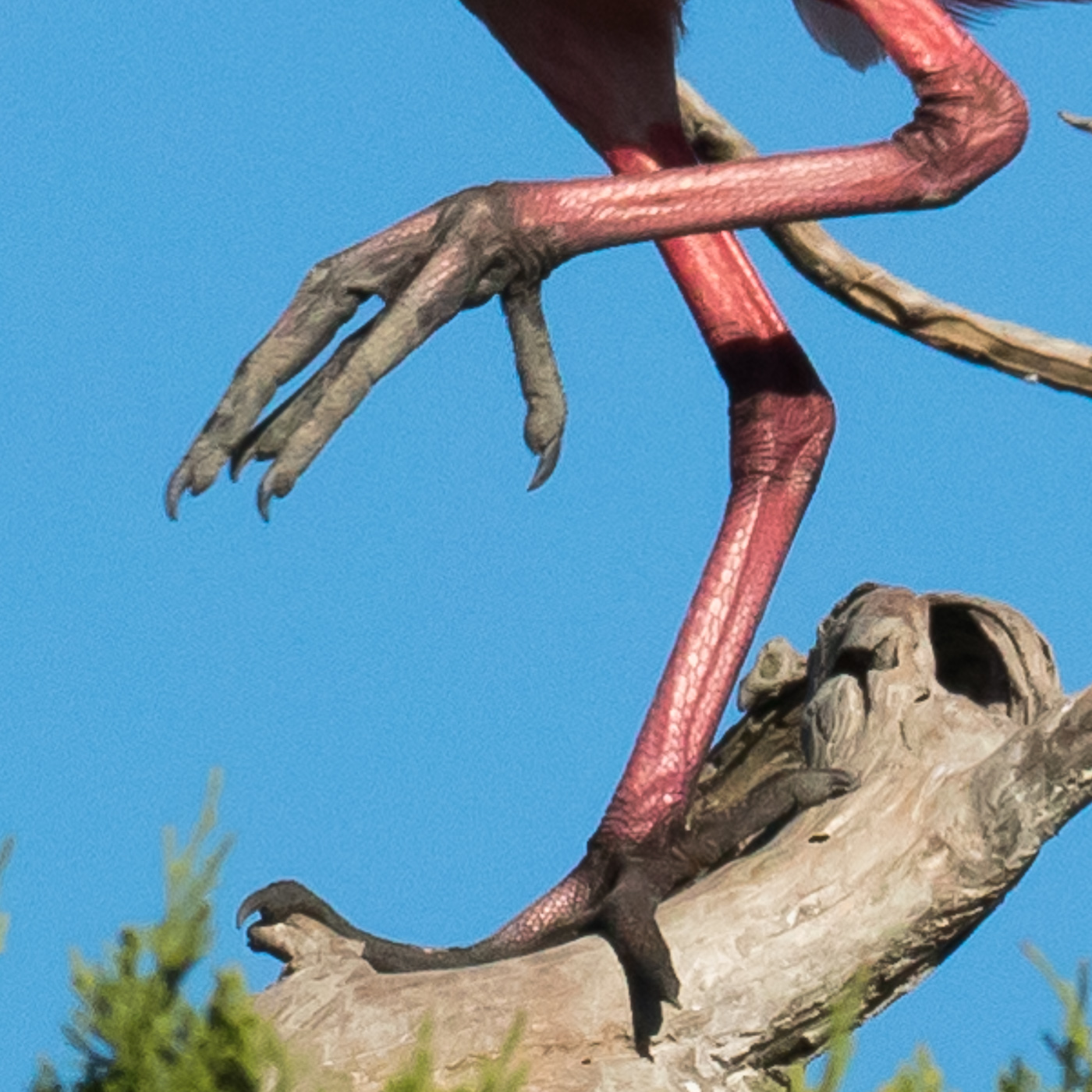
I can grab a branch  or swirl up food from the muck with these

I can grab a branch or swirl up food from the muck with these

I don’t need the eyes of a hawk, but it’s sure nice they match my apparel

I don’t need the eyes of a hawk, but it’s sure nice they match my apparel

Do you agree these are my best feature?

Do you agree these are my best feature?

Sky(lum)'s the limit

I’m attending the Florida Birding and Photography Festival in St. Augustine this week. My first event was a sunrise boat ride into St. Augustine Bay and the estuary. with eight other birders and photographers. As we were heading out, I realize I’m chatting with Scott Bourne who is one of the great bird photographers. He’s also President of Skylum software. I was a bit embarrassed to say I’d purchased their Luminar software but hadn’t yet used it! So now I’m giving it a go. I’m just learning and I’m processing these images on a laptop that doesn’t have the best resolution, so hope these come out OK. Also, learned that Scott’s a great guy!

Sunrise over St. Augustine Bay

Sunrise over St. Augustine Bay

Crossing the Sky

Crossing the Sky

That evening, I did a shoot of the nesting birds at St. Augustine Alligator Farm. Most species were still on their eggs but some Great Egret chicks were getting quite big. This trio acted like squabbling siblings. Even though nearly as large as the adult, and so getting ready to fledge, you can easily tell the difference between the adult in the next image who has breeding plumage and green lores (the areas between the eye and beak.

Great Egret trio, St. Augustine Alligator Farm

Great Egret trio, St. Augustine Alligator Farm

Great Egret_0909.jpg

The next morning I took a kayak trip into the Matanzas River estuary at low tide. Many birds were feeding in the muck and low water. Sometime in the future, I’ll post images of a pelican following a pod of dolphin and feeding the fish they would stir up. As for now, here is a juvenile pelican and a Willet feeding among the oysters.

Juvenile Pelican, Matanzas River estuary

Juvenile Pelican, Matanzas River estuary

Willet feeding

Willet feeding

This morning’s shoot of horses on the beach at sunrise was cancelled because of a threatening storm. One of the photographers was immediately leaving to head home and he convinced one of the riders to stay and hope the storm would pass. It did! So a few of us were able to get some images of this beautiful pair. Thanks Kari Coad!

Butler Beach, St. John’s County, FL

Butler Beach, St. John’s County, FL

In the beginning . . .

Passover begins tonight and Christians are in the middle of the Easter Triduum. I have been privileged for many years to recite the creation story to begin the readings for the Easter Vigil service in our parish. Jews and Christians share this same Torah preamble to scriptures, and the Qur’an shares many of the verses. I’d be hard pressed to find more beautiful poetry.

1 abyss 7108.jpg

In the beginning, when God created the heavens and the earth, 
the earth was a formless wasteland, and darkness covered the abyss, 
while a mighty wind swept over the waters.

Then God said,
"Let there be light," and there was light.
God saw how good the light was.
God then separated the light from the darkness.
God called the light "day," and the darkness he called "night."
Thus evening came, and morning followed—the first day.

1+Melb+Beach+sunrise.jpg


Then God said,
"Let there be a dome in the middle of the waters, 
to separate one body of water from the other."
And so it happened:
God made the dome, 
and it separated the water above the dome from the water below it.
God called the dome "the sky."
Evening came, and morning followed—the second day.

3 clouds 2012 MCO.jpg

Then God said, 
"Let the water under the sky be gathered into a single basin, 
so that the dry land may appear."
And so it happened:
the water under the sky was gathered into its basin, 
and the dry land appeared.
God called the dry land "the earth, " 
and the basin of the water he called "the sea."
God saw how good it was.

Glen Canyon, AZ

Glen Canyon, AZ

Then God said,
"Let the earth bring forth vegetation: 
every kind of plant that bears seed
and every kind of fruit tree on earth 
that bears fruit with its seed in it."
And so it happened: 
the earth brought forth every kind of plant that bears seed 
and every kind of fruit tree on earth 
that bears fruit with its seed in it.
God saw how good it was.
Evening came, and morning followed—the third day.

Manoa Falls, Oahu

Manoa Falls, Oahu

Then God said:
"Let there be lights in the dome of the sky, 
to separate day from night.
Let them mark the fixed times, the days and the years, 
and serve as luminaries in the dome of the sky, 
to shed light upon the earth."
And so it happened:
God made the two great lights, 
the greater one to govern the day, 
and the lesser one to govern the night; 
and he made the stars. 
God set them in the dome of the sky, 
to shed light upon the earth,
to govern the day and the night, 
and to separate the light from the darkness.
God saw how good it was.
Evening came, and morning followed—the fourth day.

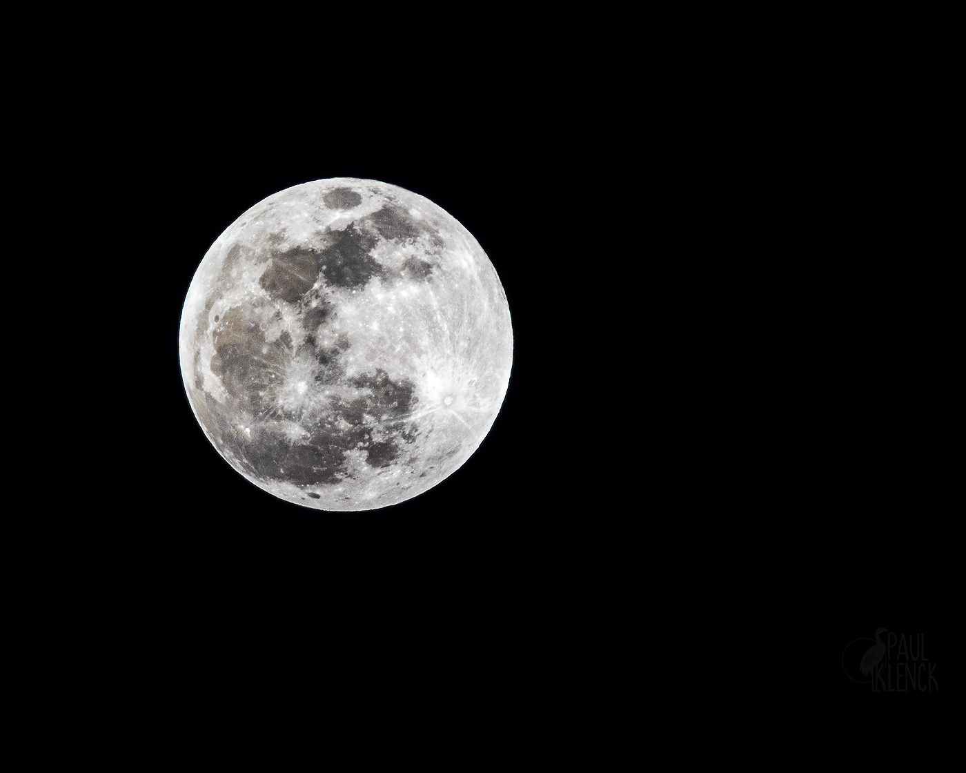
4 Lunar  2019Jan20-3004.jpg
Salmon River, Idaho

Salmon River, Idaho

Then God said, 
"Let the water teem with an abundance of living creatures, 
and on the earth let birds fly beneath the dome of the sky."
And so it happened:
God created the great sea monsters 
and all kinds of swimming creatures with which the water teems, 
and all kinds of winged birds.
God saw how good it was, and God blessed them, saying, 
"Be fertile, multiply, and fill the water of the seas; 
and let the birds multiply on the earth."
Evening came, and morning followed—the fifth day.

Bosque del Apache, New Mexico

Bosque del Apache, New Mexico

Then God said, 
"Let the earth bring forth all kinds of living creatures: 
cattle, creeping things, and wild animals of all kinds."
And so it happened:
God made all kinds of wild animals, all kinds of cattle,
and all kinds of creeping things of the earth.
God saw how good it was.

Pronghorn, North Dakota

Pronghorn, North Dakota

Then God said: 
"Let us make man in our image, after our likeness.
Let them have dominion over the fish of the sea, 
the birds of the air, and the cattle, 
and over all the wild animals 
and all the creatures that crawl on the ground."
God created man in his image;
in the image of God he created him;
male and female he created them.
God blessed them, saying:
"Be fertile and multiply;
fill the earth and subdue it.
Have dominion over the fish of the sea, the birds of the air, 
and all the living things that move on the earth."

6 surf.jpg

God also said: 
"See, I give you every seed-bearing plant all over the earth 
and every tree that has seed-bearing fruit on it to be your food; 
and to all the animals of the land, all the birds of the air, 
and all the living creatures that crawl on the ground, 
I give all the green plants for food."
And so it happened.
God looked at everything he had made, and he found it very good.
Evening came, and morning followed—the sixth day.

Cades Cove, Smoky Mountains National Park

Cades Cove, Smoky Mountains National Park

Thus the heavens and the earth and all their array were completed.
Since on the seventh day God was finished
with the work he had been doing, 
he rested on the seventh day from all the work he had undertaken.

Genesis 1.1 - 2.2

Zabriskie Point, Death Valley National Park

Zabriskie Point, Death Valley National Park

Last evening with Roosevelt

I’ve enjoyed reviewing these images from the Dakotas. Here is the last set of evening light and sunset images from the South Unit of Theodore Roosevelt National Park. The South Unit has wild horses who roam the prairie. This young colt was playing on the hills and then ran to mom for some milk and rest. The owl might be tiny in the second image, but I think it makes the shot.

Mother and child reunion

Mother and child reunion

Great horned owl, Theodore Roosevelt National Park

Great horned owl, Theodore Roosevelt National Park

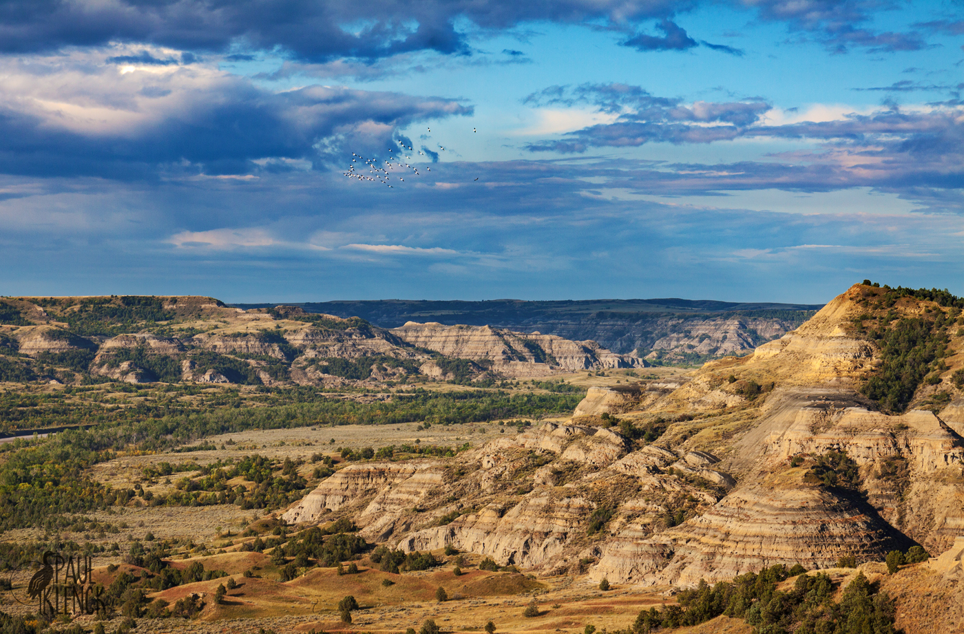
The South Unit is primarily accessed through a loop road that circles a wonderful, undulating landscape of knobs and buttes. Some distant peaks surround the park. Theodore Roosevelt escaped to his nearby ranch after his wife and mother died on the same day in his New York City home. The land helped him build his strength in his youth and his resilience later.

Badland view, Theodore Roosevelt National Park, South Unit

Badland view, Theodore Roosevelt National Park, South Unit

Roosevelt sunset

Roosevelt sunset

Bison Dogs

Another group of reprocessed images from my trip to the Dakotas several years ago. I was greatly surprised by the diversity of Theodore Roosevelt National Park in western North Dakota. The park has two primary units conveniently called North and South Units. The North Unit has some wonderful badland scenery and a wide valley created by the Little Missouri River. There are also lots of Bison. I was on the search for badgers—a creature I’ve never seen. I read they’re sometimes found digging for prairie dogs. So I was up before dawn hiking to a prairie dog town. I was greeted with a pleasant sunrise.

Theodore Roosevelt National Park, North Dakota

Theodore Roosevelt National Park, North Dakota

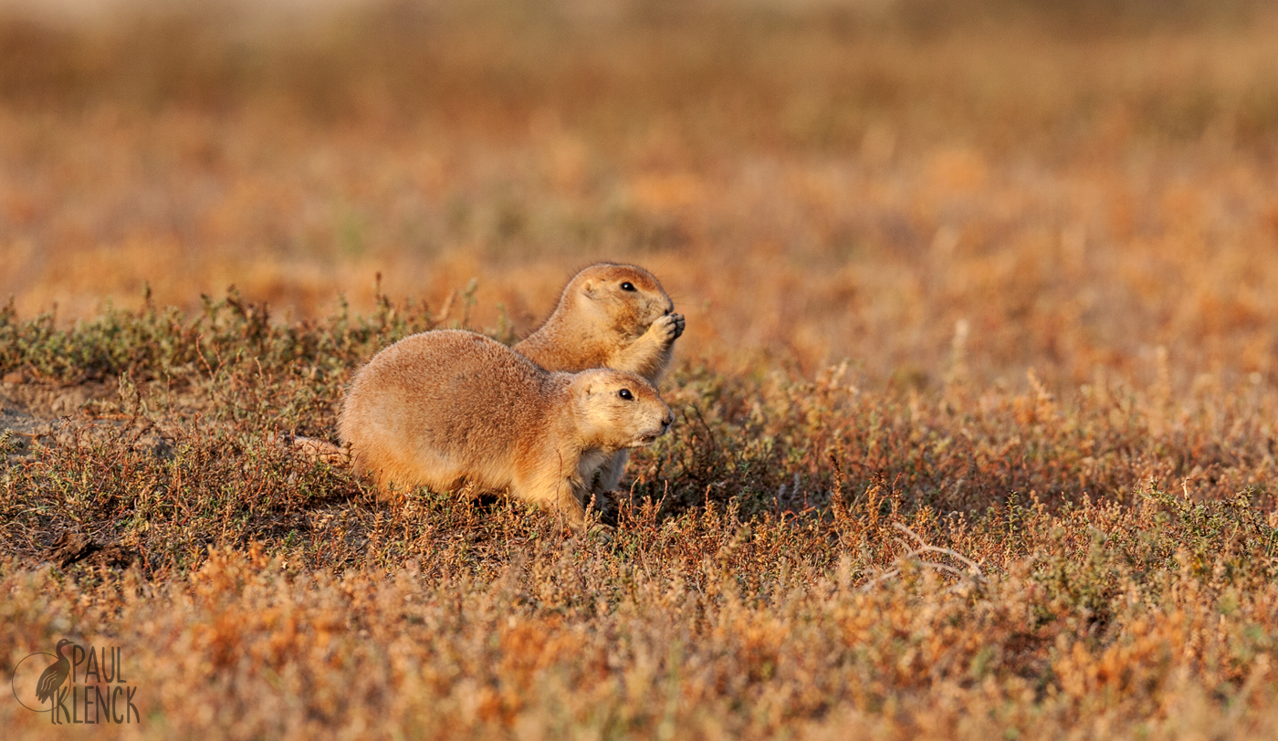
I found the prairie dog town and settled in to look for badgers. No badgers. No prairie dogs. Not much of anything going on. I discovered that prairie dogs sleep in late. Finally, they started popping out of their burrows.

Prairie dog breakfast

Prairie dog breakfast

I had fun watching the little fellows, but was ready to move on after laying on my stomach photographing the guys. As I was getting up, I looked behind and saw a crowd coming up on either side of me.

Bison approach

Bison approach

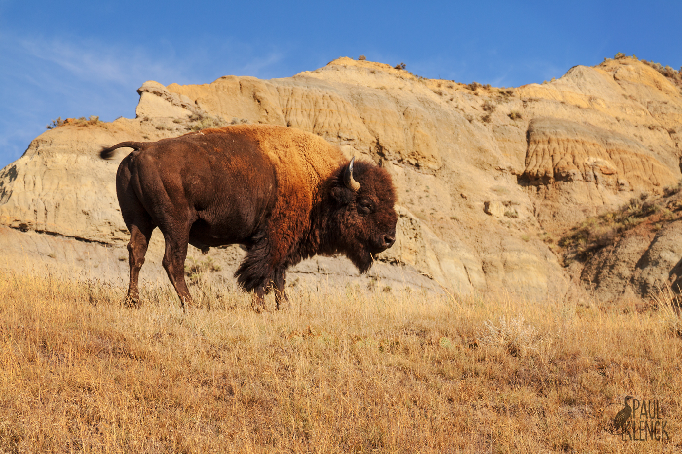
I hoped the herd would continue on an walk by me. But they decided the prairie dog town was a nice place to stop and graze. I was stuck. But it gave me a chance to get a family portrait.

Bison family

Bison family

I was stuck for well over an hour as the bison munched on the grass, with the big bulls keeping their eyes on me. I finally told them I was very tired of waiting for them to move and that I would slowly walk out. I gathered my equipment, talked softly and tried to keep as much distance as I could.

Bye, son

Bye, son

I made my get away. That evening, I was rewarded with a nice flock of pelicans flying over the Little Missouri Valley before the sun set.

Pelican flock above the valley

Pelican flock above the valley

Sunset over the Little Missouri River Valley

Sunset over the Little Missouri River Valley

Dreamland, Badland

Several friends have said they are planning trips west this year and will visit Badlands National Park in South Dakota. The park is one of my favorite, but it’s been 10 years since I was last there. I returned to my images from that brief visit, and had some fun working on them. The tools for image adjustments have improved in that time, and so have my processing abilities, so I had some fun reworking some of the old images. The mid-day light is harsh, but magic happens as the sun gets low. However, one mid-day opportunity presented itself when rangers were doing a prairie burn. Aside from the badlands themselves, most of the park is short grass prairie.

Inferno

Inferno

Once the sun gets low, the colors come out. Here is a formation with a pretty obvious name—Yellow Mounds! Can you spot the RV in the distance on the top ridge in the middle of the image?

Yellow Mounds, Badlands National Park, South Dakota

Yellow Mounds, Badlands National Park, South Dakota

Some starker formations are further west near Sage Creek, and I got some images of the grasslands and badlands before the sun went down and my tent went up. Bison wandered around the campground.

Sunset panorama

Sunset panorama

Sage Creek campground

Sage Creek campground

Especially with cloudless skies, the best light often comes before the sun rises. I was up early and off to the east end of the park, where I hoped the morning light would be good. This wonderful, soft light was well before the sun rose and made the formations glow.

Badlands dawn

Badlands dawn

When the sun got to the horizon, it lit up the formations.

Sunrise on the Badlands

Sunrise on the Badlands

Once the sun got up, it became a subject, too. If anyone needs a personal photographer on their trip to the Badlands, let me know! I think it’s time for another trip.

Sun up, Badlands National Park

Sun up, Badlands National Park

Dreamland, Greenland

The flight from London to Chicago started very cloudy with little to see but occasional waves. As the flight screen showed us approaching Greenland however, the sky cleared and an amazing expanse of ice appeared.

Ice in the sea near east coast of Greenland

Ice in the sea near east coast of Greenland

Mountains spread across the southern tip of the world’s largest island. For some reason, my head was playing Joni Mitchell’s song of a flight but substituting “Greenland, Greenland.”

With dreamland coming on
Dreamland, dreamland

In a plane flying back to winter

Wings over Greenland, Greenland

Wings over Greenland, Greenland

The middle of the island was a big sheet of glacier and snow. Slovenian National Geographic photographer Ciril Jazbec has a remarkable project of the Inuits of Greenland and the devastation climate change has on their life: On Thin Ice.

Mountain peaks over glaciers

Mountain peaks over glaciers

Watching the flight path and mileage counter on the seat back showed an incredible coincidence. At the precise halfway point between London and Chicago we were flying over a seahorse-shaped island on the west coast of Greenland.

Seahorse island

Seahorse island

Because of the distinctive shape of the island and this last one on the east coast, it was easy to find on Google Maps. Remarkably, there is a small village just southwest of here named Arsuk. Can you believe there is a Google Maps street view! Very soon the flight was completely cloud covered.

Lands end, east coast Greenland

Lands end, east coast Greenland

Scottish views

Views from Stirling castle. First, the William Wallace memorial from across the valley.

William Wallace memorial

William Wallace memorial

20190315_082951.jpg
Dog walkers

Dog walkers

Clearing

Clearing

Stacking Up

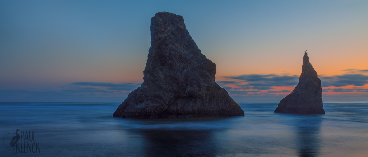
Sea stacks are an iconic scene of the U.S. Pacific coast. On the north coast or Oregon is the long, sandy Cannon Beach. The largest feature is called Haystack. Over 200 miles south is Bandon Beach. Here are two images in the “golden hour,” the hour or so near sunrise or sunset.

Haystack, Cannon Beach, Oregon

Haystack, Cannon Beach, Oregon

Bandon Beach, OR

Bandon Beach, OR

Well before sunrise, or here after sunset, is the blue hour.

Blue Cannon Beach

Blue Cannon Beach

Bandon Blue

Bandon Blue

A Thousand Mornings - Mary Oliver

How did I not know of Mary Oliver until I read her obituary last month? She was one of the best selling American poets with thirty books, and won a Pulitzer in 1984. She wrote crystalline images of nature that led to her observations of mortality and living a full life. I have been absorbed in her wonderful works. Some excerpts with my images follow. These small portions of her poems only hint at her profound insights.

Evidence

 . . .

Memory: a golden bowl, or a basement without light.


For which reason the nightmare comes with its

painful story and says: you need to know this.


Some memories I would give anything to forget.

Others I would not give up upon the point of

death, they are the bright hawks of my life.

. . .        

                Evidence, 2009

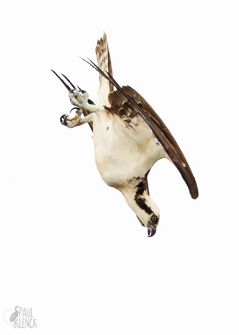
Osprey a/k/a Fishhawk, Goodwin Waterfowl Management Area, Brevard County, FL

Osprey a/k/a Fishhawk, Goodwin Waterfowl Management Area, Brevard County, FL

Red-shoulder hawk, Goodwin WMA

Red-shoulder hawk, Goodwin WMA

White Heron Rises Over Blackwater

. . .

or the white heron

   rising

      over the swamp

         and the darkness,


his yellow eyes

   and broad wings wearing

      the light of the world

         in the light of the world—


ah yes, I see him.

   He is exactly

      the poem

         I wanted to write.

New and Selected Poems: Volume Two, 2005

Great Heron preening, St. Augustine Alligator Farm

Great Heron preening, St. Augustine Alligator Farm

Catbird

. . .

He is neither the rare plover or the brilliant bunting,

   but as common as grass.

His black cap gives him a jaunty look, for which

   we humans have learned to tilt our caps, in envy.

. . .

Owls and Other Fantasies, 2003

Catbird, Everglades National Park

Catbird, Everglades National Park

Do Stones Feel?

. . .

Is the tree as it rises delighted with its many

   branches,

each one like a poem?


Are the clouds glad to unburden their bundles of rain?


Most of the world says no, no, it’s not possible.


I refuse to think to such a conclusion.

Too terrible it would be, to be wrong.

Blue Horses, 2014

Oak, Paynes Prairie Preserve State Park, Florida

Oak, Paynes Prairie Preserve State Park, Florida

Sunset rain, Viera wetlands

Sunset rain, Viera wetlands