To explore strange new (Toadstool) worlds

The Escalante River area in southern Utah was the last area of the United States to be mapped. Geologic wonders are found throughout the area. You might remember a post I did in 2018 about the Toadstool area of Grand Staircase-Escalante National Monument. I revisited earlier this month. As we were driving from Kanab, Utah under the blue morning sky, we noticed clouds ahead and wondered whether it was fog. Not long before the Toadstool hike, we were enveloped in the cloud, not to see the sun again until we drove away. Since the temperature was just below freezing, hoarfrost covered the landscape.

Toadstool Trio

Toadstool Trio

You can see the frost lightly covering the red sandstone. When I wrote about this area in 2018, President Trump had just reduced the protections President Obama had placed on the area creating Bears Ears National Monument. This Toadstool area was one that lost protection. QT Luong is a great photographer of U.S National Parks. You might’ve seen him featured in Ken Burns’ documentary on National Parks. His photography guide to the Parks is priceless, well very pricey, but worth it. He just wrote about some of the magnificent areas in Grand Staircase-Escalente that are at risk including Toadstools.

Toadstools, Grand Staircase-Escalante National Monument

Toadstools, Grand Staircase-Escalante National Monument

The real wonder were the plants covered in the hoarfrost in the washes down below the toadstool area.

Toadstool triangle-2140.jpg

Just below the area pictured above, I was stopped in my tracks by the beauty of an exotic, frost-covered plant.

Desert Trumpet

Desert Trumpet

Eriogonum inflatum

Eriogonum inflatum

I searched to identify the plant, and found that it’s named Desert Trumpet because of the bulbous areas in the stem. An article said scientists first believed the swollen areas were caused by insect larva, but later realized the insects were just taking advantage of the natural bulbous area. It’s caused by CO2 regulation, so its caused by gas. Perhaps we can petition to rename it the Desert Trump.

Toadstool desert trumpet close-2972.jpg

As I was thinking about writing this post, I immediately thought of Star Trek. Hiking here was likely walking on one of the strange planets the Enterprise explored. So imagine my amazement when I finally discovered the identity of the Desert Trumpet, and then the article had a reference to it in Star Trek: Voyage, Season 3, episode 1. Unfortunately, I can’t figure out how to get a screenshot of the scene it is shown in, probably because of copyright protections. Oh well, you can watch the episode on Amazon for the split second view of the Trumpet at 3:47.

Valley of Fire

About an hour northeast of Las Vegas, not too far off Interstate 15, is Valley of Fire State Park. We just had time to break up a drive with a couple short hikes. The park has many petroglyphs. A very easy climb up some stairs on Atlatl Rock is this collection that is an estimated 4,000 years old. The fellow with a spear is called an atlatl. The picture after that is the view from the glyphs with the rocks aglow showing how the park got its name.

Allatl Rock Petroglyphs

Allatl Rock Petroglyphs

Valley of Fire State Park Nevada

Valley of Fire State Park Nevada

We didn’t find the petroglyphs that are in a box canyon on Mouse’s Tank trail, but it did provide great scenery.

Mouse’s Tank Trail

Mouse’s Tank Trail

The hike does show the tank and provides nice viewpoints.

Mouse’s Tank catchment

Mouse’s Tank catchment

Mouse’s Tank trail view

Mouse’s Tank trail view

Making Tracks

The Field Museum of Natural History in Chicago has one of the great dinosaur specimens—Sue, the Tyrannosaurus Rex. After two decades in the Great Hall, she was moved upstairs to a terrific new display, and the Great Hall was reorganized.

Pterosaur overlooking the Great Hall of the Field Museum

Pterosaur overlooking the Great Hall of the Field Museum

Sue the T. Rex

Sue the T. Rex

From the Field to in the field. Washington County in the southwest corner of Utah has incredible geologic diversity. We followed a trail on Bureau of Land Management area just outside St. George that promised finding some dinosaur tracks at the bottom of a wash.

Dino Cliffs Trail

Dino Cliffs Trail

Soon enough after a bit of a search we came limb to limb to what some Jurassic Era creatures left in the mud.

Grallator tracks

Grallator tracks

In 2000, St. George optometrist Sheldon Johnson was developing his land and looked at one of the blocks of sandstone overturned. He discovered what is still being explored as one of the best dinosaur tracks sites. In 2005, a museum was built over part of the site. We got a private tour by a retired Canadian geologist who might’ve had more fun showing us the exhibits as we did exploring. It started with an impressive Dilophosaurus footprint where you can see the claws and toe pads and cracks in the mud as if where made last week, not 200 million years ago.

Eubrontes tracks-3957.jpg

The site was the shoreline of Lake Dixie. An artist has painted a mural across the site, and you can easily imagine the muddy shoreline where dinosaurs ran. The floor of the museum is filled with tracks and other impressions made by dinosaurs. One of the impressions in the area in the image below is a dino butt print with its feet planted just in front and hand prints on either side. Other areas show the marks left by the claws and tails of dinosaurs as they swam in the lake.

Dilophosaurus model on the fossilized mud of ancient Lake Dixie

Dilophosaurus model on the fossilized mud of ancient Lake Dixie

The block below shows the tracks of one dino running the right, another the other way, and a third cutting across. The St. George Dinosaur Discovery Site helps you easily imagine life along a Jurassic lake.

Running track

Running track

Navel gazing

A simple thing can take you miles and years away on your own travels. On a foggy, Christmas Eve morning a package of oranges came from Florida friends Karen and Gary. I immediately peeled open one of the beautiful navels. The peeling alone with the smells and textures took me back to growing up with an orange grove in the back yard.

A sign out front said “Fruit for Sale.” When someone would come down the driveway, I’d tell the price of a peck, half bushel or full bushel of what was ripe—tangelos, tangerines, temples, hamlins, grapefruit, lemons—or the most expensive—navels. If they weren’t sure, I’d pick and peel one for a taste. Then I’d get the ladder, climb up for the fruit, and make a sale.

Peeling the fruit this morning brought me back to grass between my toes, dragonflies fleeing from birds in pursuit, and Florida sunshine.

navel oranges (1 of 1).jpg

Open Range

A similarity of driving the back roads of Utah and Scotland is that you’ve a pretty good chance of running into cows or sheep sharing the road with you. Twice in Utah I encountered riders on horseback herding along the road. Sorry, no sheep shots today, but we’ll start with a Highland coo since it is Coosday, after all, and continue with some cattle and horses from Utah.

Highland cow — Macadam award winner

Highland cow — Macadam award winner

SS Bar Ranch, Box Elder County, Utah

SS Bar Ranch, Box Elder County, Utah

In the image above, the cattle were heading to cross the road I was on, but they gave plenty of time for me to get past them before they approached. A car driving along merited no attention, but a guy standing on a ridge pointing something at them did give them pause, so I moseyed along.

SS Bar Ranch

SS Bar Ranch

Now a couple ladies from northern part of the state near Wyoming.

Wasatch mare

Wasatch mare

bear river horse grazing Utah web (1 of 1).jpg

Occasionally, some wildlife such as deer or elk will share the land, but this fellow was harrierring the pasture looking for dinner.

Northern Harrier

Northern Harrier

"Too beautiful to burn"

During U.S. Grant’s extended siege of Vicksburg, Mississippi, he attacked the confederate stronghold of Port Gibson that was opposing the Union approach to Vicksburg on the Mississippi River. Port Gibson’s fall was the last major defense of Vicksburg which Grant would finally capture on July 4, 1863. Grant was reported to say that the city was too beautiful to burn, and so many buildings survived the war. The city was incorporated in 1803 when the Louisiana Purchase brought the land into the U.S. One surviving building was the one that caused me to stop on my venture up the Natchez Trace. Historic county courthouses compel me to stop. The Claiborne County Courthouse was built in 1845, and from a distance still reflects the Greek Revival glory of the 19th century, but close up shows the poverty of 21st century rural Mississippi.

Claiborne County Courthouse, Mississippi

Claiborne County Courthouse, Mississippi

While I was exploring the inside, someone saw my camera and suggested I walk over to the nearby First Presbyterian Church for some photos. She said she’d be over there in half an hour to unlock it if it wasn’t open.

First Presbyterian Church, Port Gibson, Mississippi

First Presbyterian Church, Port Gibson, Mississippi

The sign outside says it’s the second oldest Presbyterian church in the “Old Southwest” organized in 1807. The current structure was built in 1859, and so was one of the buildings left standing following the siege. The door was open.

Port Gibson 1st Presbyterian door (1 of 1).jpg
Interior First Presbyterian Church, Port Gibson

Interior First Presbyterian Church, Port Gibson

Stairs to the choir

Stairs to the choir

Often, the towns with old courthouses have an old theater nearby, and they too beckon photographs. It wasn’t there for Grant to burn, but it’s history says it has survived fires, and operates as a bar. Its name reflects the historic nearby trail.

Trace Theater, Port Gibson

Trace Theater, Port Gibson

What routed me through Port Gibson was a diversion to another historic spot off the Trace. The state preserves the ruins of the largest antebellum Greek Revival mansion—now called Windsor Ruins. It, too, survived the war, but burnt down in 1890. All that survive are the twenty-nine, 50 foot columns giving silent testimony to the three-story, 25 room mansion that commanded views over the Mississippi and the cotton plantation’s enslaved workers.

Windsor Ruins, Claiborne County, Mississippi

Windsor Ruins, Claiborne County, Mississippi

Golden

Last week I traveled to Salt Lake City for the funeral of my mother’s last of twelve siblings. It was good to be with family to remember the last of a large generation. I was able to add on a trip to place I’ve been wanting to visit for a long time—Golden Spike National Historical Park. I remember the photo from my early school days of the two locomotives meeting from East and West, and the country linked. In my mind, the scene was in the middle of the flat, salt desert. I guess I should’ve taken a hint that the place was called Promontory Point! The day far exceeded my expectations.

The drive began by ascending from the flats near the Great Salt Lake to a wonderful view into the basin.

Sunrise over Great Salt Lake Basin

Sunrise over Great Salt Lake Basin

The venture began only 73 years after twelve independent states ratified the Constitution. A continental country in the midst of a civil war passed the Railway Act of 1862. With resources and manpower diverted by the war, the two train lines began from Omaha and Sacramento.

A wonderful project the National Park Service has recently begun is creating audio tours along hiking trails. With limited cell phone service, only the eastern edge of this park can support one. But a great hike it is on two of the old railroad beds called the Big Fill trail. I wrongly assumed the meeting of the railroads was a well-organized, thoughtful plan to pick out a good meeting spot. Instead, with no leadership from Congress, the competing Union Pacific RR and the Central Pacific RR raced to lay down railroad beds in order to claim rights to the surrounding land. They ran parallel track beds for over 250 miles!

One of the final engineering hurdles was crossing a large ravine in the Promontory Mountains near where they’d eventually agree to join the lines. Congress mandated that the track grade never be more than 2%, so crossing the mountains was an engineering feat. In this image, I’m standing on the “Big Fill” that the Central Pacific built across the ravine. Lower on the ravine to the left is where the Union Pacific began a trestle that reached across the ravine. You can also see the narrow notches carved out of the ridge on the other side. When the war was on, all the labor was done by Chinese, Irish and other immigrant labor with hand tools carving the land. Later, former soldiers and settlers joined the workforce.

Bill Fill trail, Golden Spike National Historical Park, Utah

Bill Fill trail, Golden Spike National Historical Park, Utah

Eventually, agreement was reached on where to join the lines, but the competing crews raced to lay track on road beds that had been laid. An average of one mile of rail was laid during the construction, but the Union Pacific crew laid down 8.5 miles one day. The Central Pacific crew tried to beat them on the final days before reaching Promontory Point. In the west part of the park, there is an auto trail on the old rail bed, and a sign modeled after the one the Central Pacific crew erected commemorates the effort.

West Auto Tour route

West Auto Tour route

On May 10, 1869, the presidents of the companies met, crowds came on the trains, the crews gathered, telegraph operators were ready the transmit messages on the first transcontinental lines that were also installed as part of the project. Almost exactly 100 years later, people would again gather to wait for the news that we’d landed on the moon. A photo was taken of the presidents attempting to hammer in the golden spike to unite the lines, but the glass photographic plate was dropped! The famous photo was recreated the next day after most dignitaries had left. In less than 40 years, this part of the train line was bypassed by a causeway across the Great Salt Lake. In 1942, the iron and steel rails were salvaged for the war effort, and the line abandoned. The golden spike is now at Stanford University founded by the Central Pacific president Leland Sanford.

Tie commemorating the Golden Spike

Tie commemorating the Golden Spike

In the 1970s, engineers attempted to recreate the two engines that met at Promontory Point. During the summer, the engines run on a mile of so of track that was replaced on the line. However, at this time of year, they go in for repair and refurbishment, but rangers lead tours on Saturdays to see the wonderful Victorian recreations of the Jupiter and the No. 119. I happened to be there on Saturday!

Ranger Lucas and the Jupiter

Ranger Lucas and the Jupiter

No. 119

No. 119

After a diversion through ranch land and a visit to the northern tip of the Great Salt Lake, I returned through Golden Spike NHP and was treated to one last Golden Spike near the Big Fill.

Golden Spike sunset over the Promontory Peaks

Golden Spike sunset over the Promontory Peaks

Thibodaux, Louisiana

The “h” is silent, the “aux” is “oh”, so TIB - e - doh. Thibodaux is an hour or so southwest of New Orleans along the banks of Bayou Lafourche. The area was settled by French colonists, and soon they and their African slaves developed sugar cane plantations. St. Joseph church was established in 1849, and the building was rebuilt following a fire in 1919. St. Joseph cemetery was also established in 1849, and many of the Thibodaux founders and decedents are buried there.

St. Joseph Church, Thibedaux, Louisiana

St. Joseph Church, Thibedaux, Louisiana

St. Joseph cemetery

St. Joseph cemetery

Sugar cane was being harvested in the parish when we drove the roads around Thibodaux. Huge trucks wound the roads and headed to the sugar mill which smelled like molasses as you drove by. Antebellum Laurel Valley Sugar Plantation was over 50,000 acres and worked by 135 slaves. Much of the land still grows cane which is now harvested by John Deere combines. A nearby general store was moved to the property, and displays tools and farm implements used to farm sugar. Some of the outdoor equipment shows the wear of Louisiana summers and storms. Like the church and cemetery, the general store is listed on the National Register of Historic Places.

Laurel Valley general store museum

Laurel Valley general store museum

Thibodaux Laurel Valley truck-2.jpg
Thibodaux laurel valley truck interior 3-2.jpg

Following the Civil War and the passage of the Thirteenth Amendment outlawing slavery, the sugar cane workers’ lives, both black and white, were little removed from slave conditions. They lived in old slave quarters, worked in gangs and were paid 42 cents a day. In 1874 some cane cutters organized to demand increased wages. The Louisiana White League fought this effort and forced out the Republican governor, and the attempted strike failed. Another strike in 1880 failed. In 1883, the Knights of Labor, then the largest union in the country, began to organized the workers. In 1887, the seven Louisiana locals asked for wages of $1.25 a day. The state militia, led by ex-Confederate General Beauregard, joined local white supremacists militias to attack strikers. Many of the displaced workers sought refuge in Thibodaux. Vigilantes barricaded the town which became a killing ground. At least 35 African-Americans in Thibodaux were among the 60 killed in the state to put down the union. Union organizing was consistently met with violence in the South, as elsewhere. Indeed, in 1968, Martin Luther King, Jr. was in Memphis supporting the sanitation workers strike when he met a violent death. The Smithsonian Magazine ran a story of the Thibodaux Massacre two years ago.

Laurel Valley has maintained the servant quarters shotgun houses that were on the plantation. A few may date to antebellum days, but most were built in the late 19th and early 20th centuries.

Laurel Valley servant quarters

Laurel Valley servant quarters

Little Brown Job? Nope, the other LBJ

Birders have an expression for a small bird that flies away before you can identify it: an LBJ, a little brown job. Last week we visited LBJ National Historical Park, and though I did see a life bird who flew away just as I was focusing on it, the park is named for the 36th president of the United States. The park headquarters are in Johnson City, Texas which was named after Lyndon Baines Johnson’s ancestors. He was born about 14 miles west on the Pedernales River, but his parents move to the “city” when he was five. His boyhood home is part of the Park. An extraordinary home built for the Texas heat seems to have doors opening to the outside in every room in the house. There are two screened in back porches, one for sleeping in which reminded me of the house in Florida I moved into when I was five and had a screened porch where I’d sometimes sleep in the summer heat. The main front porch was for his mother, but the one shown in the image below was his father’s and the door opened to Lyndon and his brother’s bedroom. His father was in the Texas House of Representatives and would have frequent meetings on this porch. LBJ started developing his mastery of politics by listening in to the conversations on this very porch.

Lyndon Baines Johnson boyhood home, Johnson City, TX

Lyndon Baines Johnson boyhood home, Johnson City, TX

LBJ and Lady Bird donated this home and a large portion of their ranch to the National Park Service with a stipulation that there never be an entrance fee, and that the ranch always continue to be a working ranch. However, to get to the National Park site, you need to stop at the surrounding Texas State Park and get a permit to enter.

LBJ ranch sign-6657.jpg
LBJ ranch and Hereford cattle

LBJ ranch and Hereford cattle

After Johnson’s aunt “bought the ranch,” he bought the ranch. The land included the house where he was born, and, right next to this sign, the one room school he attended for a few months before his parents moved to Johnson City. Johnson returned to the school on April 11, 1965 to sign the Elementary and Secondary Education Act sitting next to his first teacher and using a desk from the school. The desk is on display in the visitor center. ESEA has been reauthorized many times to continue federal funding of public education, though it was renamed the “No Child Left Behind Act” by George W. Bush and Betsy DeVos when they attempted to use the law to damage public education and encourage private schools. Johnson paused his college education to teach for one year at the segregated school for Mexican-Americans in Cotulla, Texas. The experience had a profound effect on his life-long commitment to education and racial justice. To compare to the lack of our national government to pass any legislation now, some of the education bills Johnson pushed for and signed include: the Higher Education Act, Vocational Education Act, Manpower Development and Training Act, Library Services and Construction Act, Indian Vocation Training Act, Cold War GI Bill, Head Start, Education Profession Development Act, Public Broadcasting, Upward Bound, The Teacher Corps and the Adult Education Act.

Desk where LBJ signed ESEA

Desk where LBJ signed ESEA

LBJ spent much of his presidency at the Texas White House. The ranch house had already been expanded by Johnson, but after he became president Lady Bird insisted that new bedrooms be added for each of them so she would not wake up to find Secret Service agents hovering over her. The pool had been added in 1955 after the doctor ordered LBJ to exercise more after a heart attack nearly killed him. However, Johnson just got a long telephone cord so he could sit in the pool and continue to use one of his main political tools. The house has been closed for tours since August when a branch from the 300 year old Live Oak tree fell on the front lawn, and some structural defects were found. The dead branch is still on the left edge of this image which is where the oldest part of the house is.

Texas White House

Texas White House

Changes to the ranch included lengthening the runway that ended just behind the house. The runway still could not support the weight of Air Force One, so Air Force One Half brought LBJ to the ranch from Austin. In addition to the plane, Johnson’s many cars and even golf carts are on display. The old airplane hanger that was also used to screen movies and host parties is now part of the visitor center.

Air Force One Half

Air Force One Half

Because he often had more visitors then could stay in the house, Johnson had his boyhood home reconstructed to look exactly as it had when he was born there. Robert Caro’s first book of his still uncompleted biography of Johnson, the 1982 The Path to Power, describes the powerful influence growing up in this dogtrot house had on Johnson. LBJ and Lady Bird are buried just a hundred yards away.

Reconstructed LBJ birthplace

Reconstructed LBJ birthplace

Remember the Mission

UNESCO has recognized the five Spanish missions set along ten miles of the San Antonio River as a World Heritage Site. For 10,000 years numerous small communities of hunter-gathers lived in southeast Texas. In the late 17th Century they were under attack by the newly-mounted Apache tribes to the north, by diseases from the Europeans settling to the south, and persistent drought. The Spanish government was trying to expand its control of New Spain, and oppose the expansion of France near the Mississippi River, and it encouraged the Franciscan Order to establish missions in what is now east Texas. Eventually, one of the missions moved to what is now known as the Alamo in central San Antonio. Soon another mission San José y San Miguel de Aguayo started nearby. By the mid-eighteenth century the mission moved to its current location about six miles south of the Alamo. In 1759, the plaza was enclosed by walls, and soon thereafter a new stone church was built by the natives using a European design from the Franciscans.

Mission San Jose compound

Mission San Jose compound

350 Indians lived in residences along the walls, farmed and ranched the area, ran mills and other crafts.

Residences on the Mission San Jose courtyard

Residences on the Mission San Jose courtyard

The new Mexican government began to secularize the missions. By 1824, San Jose was fully secularized. Later the military occupied the walled grounds. In 1859, the church was reopened for services, but part of the walls and dome collapsed in 1868, and the bell tower collapsed in 1928. Soon thereafter, a reconstruction effort began. The church here, as well as in the three other nearby missions, are parishes for the San Antonio diocese, and the surrounding land is protected as the San Antonio Missions National Historic Site.

San Jose mission church

San Jose mission church

Mission San Juan Capistrano moved from east Texas to its current location 2 1/2 miles south of San Jose in 1731. The current church is at least the third on the site and was built in 1796. This mission, too, was secularized by 1824, and then reopened as a parish church in 1909. Many of the current parishioners are decedents of the original mission inhabitants.

Mission San Juan Capistrano

Mission San Juan Capistrano

A trail extends along the San Antonio River, and bike rental stands are located by each mission and other locations along the trail. I hopped on another bike and headed 1 1/2 to the furthermost south mission — Mission San Francisco de la Espada which moved here in 1731. Unfortunately, it did not protect the natives as promised when Apache’s raided the mission in 1736, and three years later smallpox and measles ravaged the families. Like Mission San Juan, the church has an elegant three-bell campanario.

Mission Espada

Mission Espada

The furthest north of the four missions that are part of the National Historic Site is Mission Nuestra Señora de la Purísima Concepción de Acuña—the Immaculate Conception. The church was completed in 1755 and is considered the oldest and best preserved Spanish colonial church in the U.S. When I visited one of the parishioners spoke about the history of the mission and the architecture of the church. On August 15, the feast of the Assumption of Mary, at 6:30 p.m. the evening sunlight shines through the west rose window and illuminates the very center of the cruciform church building while the light through the window in the dome illuminates the face of Mary on the 1676 painting that hangs behind the altar. While other churches have seasonal illuminations, Mission Concepcion is the only one that has a double illumination.

Mission Concepcion church

Mission Concepcion church

The Mission Concepcion church was built on the site of the limestone quarry that was used to construct the Alamo two miles north and Mission San Jose three miles south.

Mission San Antonio de Valero moved to its current location in 1724 and served as a mission until 1793, and gave its name to what is now the eighth largest city in the U.S. The mission then became a Spanish military outpost to protect against threats by France and the new United States. When Mexico gained independence in 1821, the outpost became known as the Alamo—Spanish for cottonwood. The building entered Texas and American legend after General Santa Anna laid siege to the fort and on March 6, 1836 killed the 189 defenders including Davy Crockett and Jim Bowie. Today, you can wait in line, get your picture taken outside the building, but you must remove your hat and can’t take any pictures in a building that hasn’t been used as a church for over two centuries. The Alamo is protected by the State of Texas and not part of the San Antonio Missions National Historic Site.

The Alamo, aka Mission San Antonio de Valero

The Alamo, aka Mission San Antonio de Valero

End of the Earth . . . or its center?

In modern travel of planes and auto, a journey to the island of Iona seems like a journey to the edge. From the western coast of Scotland, you need to take a ferry to the Island of Mull, then drive the scenic peninsula called the Ross of Mull to its western tip, move through the free-range Highland cows and black-faced sheep to the hamlet of Fionnphort to get on another ferry for the short ride to the tiny island.

Iona and the Abbey seen from Fionnphort

Iona and the Abbey seen from Fionnphort

While Mull is geologically young of volcanic origin, Iona is an outcrop of Precambrian gneiss, some of the oldest rock on earth. In the Middle Ages when Celts, Picts, Britons, Scots and others traveled by boat, Iona was at the center of travel between Ireland, Scotland and England, and subject to Viking raids. In 563, Columba and twelve of his monks left Ireland and founded a monastery on Iona. From this island community, Picts and Anglo-Saxons in Britain were converted to Christianity and Iona was center of the monastic community. After Columba died, his grave and relics became a pilgrimage site. The monastery produced the Book of Kells, the greatest surviving art of the early Middle Ages. The island was filled with tall wooden and stone crosses, now known as the Celtic Cross. When the Vikings raided in the Eighth century, the books were scattered to Ireland and Scotland and most of the crosses destroyed.

St. John’s Cross and Hill of the Abbot

St. John’s Cross and Hill of the Abbot

In the early 1100s, the King of the Isles built St. Oran’s Chapel on the burial ground St. Columba established. Many nobles were interred here and the island has these ancient, intricate burial slabs on display, and legend holds that many Scottish kings, including Duncan and Macbeth were buried here. In 1200, Benedictine monks were invited to reinvigorate the monastery and expand the abbey. All monasteries were abandoned in the 16th century Reformation, and Iona fell into ruin.

Iona Abbey, St. Oran’s Chapel and Reiling Odhrain burial ground

Iona Abbey, St. Oran’s Chapel and Reiling Odhrain burial ground

The Abbey church and effigies of early abbots

The Abbey church and effigies of early abbots

West Highland graveslab

West Highland graveslab

The ruins began to be restored in the 20th century, and in 1938 the ecumenical Christian Iona Community was founded. Community members live in the cloisters and worship in the chapels and abbey. While some fragments of the original cloisters remain, it was mostly rebuilt in the 1950s, and sculptor Chris Hall carved stunning new piers and capitals from 1967 to 1997.

Iona cloister

Iona cloister

Though the medieval ruins and reconstructions seem to take you back to ancient times, a walk across to the west side of the island takes you to the truly primeval site where the ancient rocks meet the ocean.

North beaches of Iona

North beaches of Iona

View to the Island of Staffa

View to the Island of Staffa

Tidepool

Tidepool

Iona beach barnacles limpets-1381.jpg

Dunnottar - Ruins above the North Sea

Of the Scottish castles we visited, none had a more dramatic location than Dunnottar perched on an isolated rock hundreds of feet above the North Sea. The approach is through rolling fields, until the land falls off and the castle rises above the ocean.

The Mearns

The Mearns

Dunnottar Castle headlands - the tall Keep in the foreground

Dunnottar Castle headlands - the tall Keep in the foreground

The location had likely been a religious spot for hundreds of years before the chapel was built in 1276, and is now the oldest of the buildings remaining on the site. Two decades later, English troops fled here from their defeat by William Wallace at Stirling Bridge and were massacred by the chapel or thrown off the cliffs.

The first stone castle was constructed in 1392, and church leaders excommunicated Sir William Keith for building a fortification on consecrated ground. Pope Benedict gave approval after Keith agreed to pay.

13th century chapel

13th century chapel

Chapel and quadrangle behind and graveyard in foreground

Chapel and quadrangle behind and graveyard in foreground

Over the next three centuries, the castle would play a role in much of Scottish history, visited by Mary Queen of Scots in 1562, and a century later by Charles II after his father had been beheaded by Oliver Cromwell. Charles’s return caused Cromwell to invaded Scotland and the Honours of Scotland—the crown, sword and sceptre—were smuggled from Edinburgh for safekeeping at Dunnottar.

After Charles died in 1685, his brother James VII of Scotland and II of England became king, and Protestant Convenantors rebelled against him. 167 of them were imprisoned in wretched conditions in a vault at Dunnottar.

The Whigs’ Vault

The Whigs’ Vault

Dunnotar window perch-.jpg

By 1719, the castle was abandoned and fell into ruin. In 1919, it was purchased by the Cowdray family who began to maintain and preserve the ruins. A view from the sea shows how imposing it is from that vantage. The castle had originally been connected by a narrow neck of land to the headlands, but that approach was also dug down, so any land approach to the castle would be across a narrow, treacherous causeway.

Seaview of Dunnottar castle

Seaview of Dunnottar castle

Dunnottar vista

Dunnottar vista

For photography geeks—the final image is 24 individual shots. 6 vertical images were stitched together for the panorama. Each of the vertical images are comprised of 4 exposures that were blended to control the dynamic range from sunlit clouds to deep shadow. Caroline spotted the vista and modeled!

The Beasts of Mull

I’m posting as the remnants of Hurricane Dorian are pouring down outside on the already wet Island of Mull in the inner Hebrides of the east coast of Scotland. As I was hiking a trail that, as many do here, was crossing through a farm field, the farmer was working on repairing a fence because, as he said, “The beasts were coming through.” Also, much of the land is open grazing, so as challenging as the single track roads are—with blind curves and hills, sharp drops, muddy shoulders, 60 mph speed limits—there are also occasional sheep or cattle on or near the road. So between the roads and hikes, I’ve encounter a few of the beasts of Mull. They are splendid, and it appears the frequent rain has kept them clean for portrait sessions. How about we start with a horse.

Mull horse-0905.jpg

Sheep are everywhere! (Except on the menu. Pork sausage, ham, bacon seems to be on every plate, but I’ve not seen a pig in Scotland. Mutton has never been offered once. Hmmm, what’s in haggis?) The sheep on the trail are pretty shy, and run away easily. And then there was this ram, I named Harold, the guard of the stone circle in Mull.

sign-1050.jpg

The white stones more or less made a path that was probably the driest route through the wet, soaked, soft pasture, over streams, through three gates, and near farm animals. Some cattle were grazing nearby and a bull and cow were doing bull and cow things. The final gate opened to pasture, and there were the standing stones in the distance. With a ram nearby who I figured would scamper off. But as I walked close to Harold, he’d walk in circles near me. Then he’d walk in circles around me. Had he been influenced by the circle of stones?

Harold-0961.jpg

I thought I’d just ignore Harold, and stand and look at the stones that I was getting closer to. And soon Harold was standing next to me and looking at the stones, too. Eventually, we both moved on for a closer look.

Mull stones ram-4994.jpg
standing stones-2.jpg

I put my hand on the tallest stone, but had no Outlander moments. Harold had moved on to eating with the ewes, and I returned to my soggy hike back. However, the cattle were now on the path. So I got a shot of the loveliest cow in that crazy green grass.

Mull cow-0990.jpg

Then one of the bulls comes up to me, and starts pushing me with his head. I tell him there is no need for that. He displays great curiosity with my camera backpack. I saw what he did when he got behind a cow and said you’re not getting behind me. I had a few more words with him until I could back away with him not following.

I got back on the road to head to my B&B at the end of the road. Some dramatic skies and impressive loch visitas caused me to look for safe places to pull over on the single track to get some images, and the sky showed promise of great sunset. Then I turned a corner, the sun broke through, and herd of Highland cattle were moving on the road and grazing aside it, and I’d made it to Scottish heaven.

Mull coo-2.jpg
coo grazing-5145.jpg

Storming the castle(s)

So far eleven castles and one palace while visiting Scotland and off to see another castle this morning when I finish this post. We’ve really been struck by the variety, and had great fun climbing the winding stairs, finding secret rooms, and ducking my head which is far too tall for life in a medieval castle. Here’s view of the three we visited our first day.

Scotland has lots of rain, sheep and wind. Our first castle stop was Lochleven castle in the middle of, well, Loch Leven. Mary, Queen of Scots, gave birth here shortly before Elizabeth arrested her. Unfortunately, the high winds prevented the ferry from taking us to the island so we had to be content with the view from shore.

Lochleven castle

Lochleven castle

We then had luck getting into Elcho castle along the RIver Tay. We were the only visitors, and had great fun figuring out where we were when exiting a door from the spiral stairs in one of the towers. This L-shaped castle was built around 1560 by the Wemyss family who had lived on this land for at least two centuries earlier. All castles in this post are under the care of Historic Scotland. If you ever will do extensive travel across the country, get a membership (and over age 60 you get a “concession”). Just visiting Edinburgh and Sterling castles will pay for the membership, and you can skip the admission lines, too! You can get the membership on-line, but allow a few weeks to get cards in the post. Also, they have costumes if you want to get into medieval garb when doing your tour.

Elcho castle

Elcho castle

There’s a wonderful orchard next to the castle. The caretaker said for a donation we were welcome to pick, and he gave a map to show which apple and plum varieties were ripe. Unfortunately, we were early for the pears.

Orchard at Elcho castle

Orchard at Elcho castle

When you are queen of the castle, you can climb to the top, enter a turret and enjoy the view of your kingdom.

Elcho castle skyline view

Elcho castle skyline view

Our final castle on day one was Huntingcastle. The caretaker at Elcho told us that it was OK we missed Lochleven, since the oldest tower in Huntingcaste was nearly identical to the one at Lochleven. The old tower is the one to the right in the image below.

Sheep in the meadow at Huntingtower castle

Sheep in the meadow at Huntingtower castle

One of the stories of the castle is that in one generation a younger brother built his castle next to his brother’s. The “newer” tower is the closer one on the left side of the image above, though both were built around 1500. In many of the castles or towers within the castle, wooden floors have either deteriorated or never been restored. You then get a nice view of the impressive interior architecture as in the next image of the left tower. The second image below is of the middle section connecting the two towers. Of course, the floors were of different height, so there’s a stairway to get from one level of the right tower to the same level of the left tower. You can also glimpse the spiral stairs in the walls.

Huntingtower castle tower-2.jpg
Huntingtower castle stair-2.jpg

What good is castle if you can’t look out the window and watch your sheep?

Huntingtower castle view

Huntingtower castle view

New River Gorge

The name is ironic since the New River is one of the oldest rivers in the country. Geologists say it is older than the Appalachian Mountains that it courses through. The deep gorge made the area inhospitable to settlement until trains arrived and soon the forests were cut and the area of southeast West Virginia was mined. The New River gorge National RIver was established to protect the area.

New River Gorge National River, West Virginia

New River Gorge National River, West Virginia

Boardwalk to bridge overview

Boardwalk to bridge overview

In 1977, the world’s longest steel arch of 1,700 feet was built to span the 3,000 feet across the gorge. You can also find it on the West Virginia state quarter.

New River Gorge Bridge

New River Gorge Bridge

What most captivated me in the park was the incredible abundance of butterflies.

Black Swallowtail

Black Swallowtail

Spicebush swallowtail

Spicebush swallowtail

New River spicebush swallowtail-2273.jpg

Wheels Across the Prairie

When we were visiting SW Minnesota with my sister and nephew, we drove by the Wheels Across the Prairie Museum in Tracy, Minnesota, and my train buff nephew suggested we visit the next day.

C & NWR steam engine

C & NWR steam engine

The 1915 Chicago & Northwestern RR steam engine dominates the view from Highway 15. The train station, though bearing the Tracy name, was an original C&NWR station moved from Volga, SD. Stations were first established about every 20 miles so the engine could refill at the water tower seen here. Laura Ingalls Wilder rode here from Walnut Grove, the next eastern stop. In the distance is the 1901 Episcopal Church which can be rented for weddings, though before the ceremony, I assume they move out the moldering casket on display inside.

The museum opened in 1985 after local citizens strove to preserve some of their pioneer heritage. While named Wheels, much of the museum consists of nearby buildings moved to the site and filled with period-appropriate furnishings. We were given a personal tour by a college student who enjoyed sharing his deep Tracy roots.

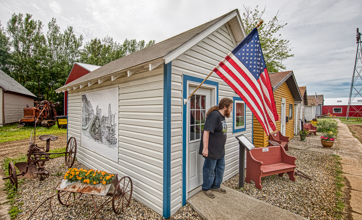
Post Office, Amiret, MN

Post Office, Amiret, MN

The summer kitchen struck a personal chord. A few days earlier, we stopped by the (now vacant) house in NE Minnesota that my mother and her eleven siblings grew up in. They had a wood burning stove just like the one on exhibit and a summer kitchen to relieve the house of the heat since the stove was always going to keep a family that size fed. The barns and animal pens that surrounded the house are all gone, but the kitchen and the old home that was originally a log cabin still stand.

Cvetan homestead, Soudan, MN

Cvetan homestead, Soudan, MN

Summer kitchen

Summer kitchen

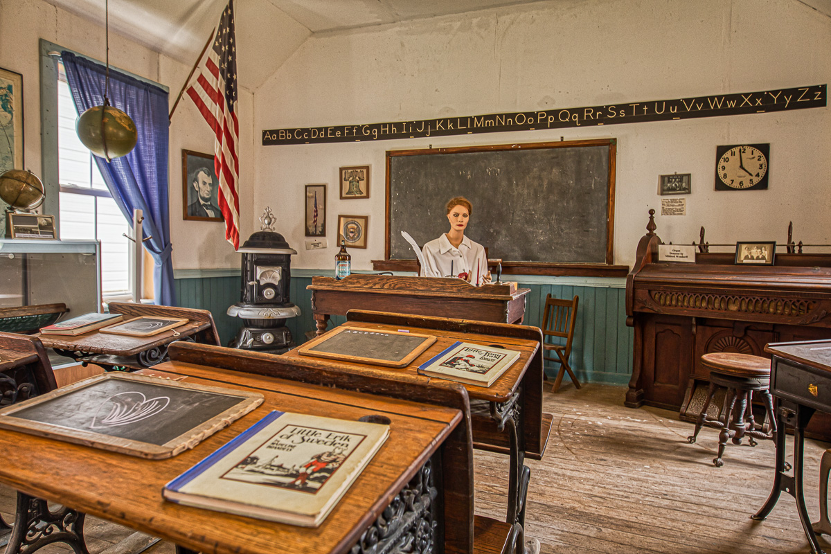
Scandinavians settled much of this part of the country, and the delightful cottage got a wonderful paint job by the owner when it was donated. Though I hope the teacher from the Murray County Schoolhouse was more friendly looking.

Wheels across the prairie tracy mn-2-5.jpg
District 91 schoolhouse

District 91 schoolhouse

The museum built a large shed to hold its growing collection, including adding the counter from the local cafe when it closed. Our college student guide was proud to show that stools he sat in as a child were now part of the collection.

Wheels across the prairie tracy mn-2-7.jpg

A local resident volunteers at the blacksmith shop, and what Great Plains collection would be complete without some tractors.

Wheels across the prairie tracy mn-2-8.jpg
Wheels across the prairie tracy mn-2-9.jpg

After working up a hunger touring on Americana, we drove into town where the old bank had been converted to Bonnie & Clyde’s Bar & Grill. What’s more American than celebrating outlaws?

Bonnie and Cyldes tracy mn-2.jpg

George Washington was here

South of St. Augustine on Florida’s Palm Coast, Washington Oaks Gardens State Park rests between the Atlantic Ocean and the Matanzas River Lagoon. This sign by the Young’s home describes the European and American history of the land.

Washington Oaks Live sign-1756.jpg

Much of the park is left in its natural state of palmetto scrub, cabbage palm, and live oak hammock, with a nature trail going through part of it.

Nature trail at Washington Oaks Gardens State Park

Nature trail at Washington Oaks Gardens State Park

The main attraction is the formal gardens which fan out from an old Live Oak covered in Spanish Moss.

Washington Oaks Live oak-2.jpg

Ponds, streams and water fountains meander through the gardens.

Washington Oaks Live gazebo-1770.jpg
Washington Oaks Live statue-9512.jpg
Washington Oaks Live fountain-2.jpg
Washington Oaks Live stream-1780.jpg

One of my favorite plants is the Resurrection Fern which often covers the massive branches of Live Oaks. The ferns curl up brown and crunchy in the dry season, but a heavy rain transforms them to full green.

Washington Oaks Live oak eye-resurrection ferns and trail

And a bonus image! North of the park on Highway A1A is Butler Beach where I made some images of horses at sunrise in the spring. The evening before I visited Washington Oaks, a rainbow appeared over the ocean, and the dunes of Butler Beach created a pleasant foreground for the bow.

Butler Beach rainbow

Butler Beach rainbow

A Peerless Last Night

Thursday was my last night in the house we moved into in 1973. I had an early dinner with my brother and sister-in-law, and I was thinking of going to a pier on the Indian River Lagoon for sunset, but it was overcast and raining, so I started driving to the theater thinking photos were not going to happen. Before getting to the theater, I noticed the sky was clearing to the west, so thought I’d wait and give the sunset a try. About 45 minutes before sunset, the clouds were heavy and dumping rain, but the clearing sky was getting closer. I hoped for something good and started driving the six miles east to the coast. The clouds stayed thick and the rain got harder. Then a golden light came from the west as the sun dropped into the clearing near the horizon, but the rain still fell and the clouds above stayed thick and gray. I got to the causeway over the river, and saw the sky clearing to the north,. Then a rainbow starting to appear ahead. Maybe it’ll be good one.

I parked by the pier, put on a raincoat, gathered my camera, tripod,a cloth to wipe the lens, and my Tilley hat—to cover my camera, not me. The golden sky to the west was looking promising. A fisherman cast his net off the pier and an osprey flew up to a tree to look over the scene.

Melbourne Beach Pier, Indian RIver Lagoon

Melbourne Beach Pier, Indian RIver Lagoon

Turning around, the rainbow was getting more intense. Looking north along the river, the colors were popping.

Melbourne Beach rainbow

Melbourne Beach rainbow

The rain continued, the sunlight got more intense, and looking west toward the ocean, the rainbow was complete. I’d try to set the camera, compose, wipe the filter, and make some images. I noticed a woman at the edge of the pier looking at the sunset. Her green umbrella was wonderful. I said I’d send her the image if she’d model for me with her umbrella. She said she was trying to stay out of my picture. I told her she was just what the image needed. She came up to the camera, and I asked her to turn, and she said, “Oh my, a rainbow!”

Double rainbow—and the one drop that got on the filter

Double rainbow—and the one drop that got on the filter

Many people from the neighborhood, park, restaurant and bar walked on the pier to enjoy the show. One woman said she’d walked here for twelve years and it was the best rainbow she’d seen.

A couple enjoying the last of the sun

A couple enjoying the last of the sun

After the sun went down, nearly everyone left the pier, but I was pretty sure the show wasn’t over. In high school, I’d go fishing with my brother on his boat on these waters. We’d set out the nets as the sun was setting and fish long into the night. That’s when I first learned the wonderful play of light on the water as the sun went down. Sure enough, with the sun below the horizon, some clouds started blushing. Or send another way, don’t leave until after the credits. There might be some more treats!

MLB Beach pier sunset pink-0860.jpg

The rain passed, and the day was offering the last of its color.

All the crayons getting used

All the crayons getting used

The rainbow was long gone, the fisherman was still casting his net, the osprey had flown off, and the sky dissolved to blue. I might watch the movie another night.

MLB Beach dusk viewer-2.jpg

Flour Power

From 1880 to 1930, Minneapolis led the country in producing flour. The city was founded on the banks of the Mississippi River by the only major falls on the river. The falls were harnessed to power mills on each bank. Grain from Minnesota, the Dakota and elsewhere was brought in by river, wagon and horse. Below is the Stone Arch bridge built in 1882 for trains and now is a bike and pedestrian bridge. In the distant center is the red sign over the Pillsbury Mill.

Stone Arch Bridge with St. Anthony Falls

Stone Arch Bridge with St. Anthony Falls

The view above is from the top of the ruins of General Mills, which started as the Washburn Mill. The mill was abandoned, but eventually converted into the Mill City Museum.

Mill City Museum from the Stone Arch bridge

Mill City Museum from the Stone Arch bridge

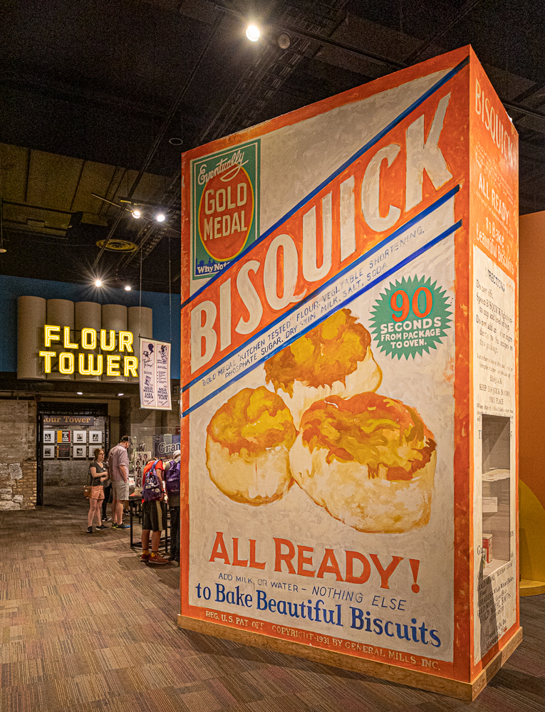
The lower floor of the museum has artifacts from flour production, milling, marketing and transportation. Washburn/General Mills was able to market its flour as “Gold Medal” because it won the top prize at the one and only International Millers Exposition in Cincinnati in 1880.

Mill city -9873.jpg
Mill city -9870.jpg

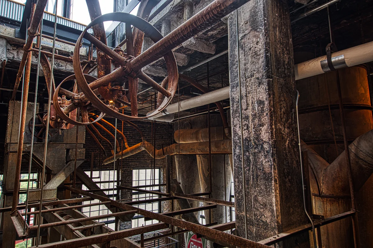
In the image above is a sign for the Flour Tower. It is one of the best museum features you’ll experience. A couple dozen people sit in a massive freight elevator that goes up and down seven stories to tell the history of the mill. If you’ve been to the Tower of Terror at Disney, it’s sorta like that, but without a free fall. You exit at the top and get to view some of the ruins of old mill, and imagine the pounding of the machines and the hustle of the workers.

Mill city power-9835.jpg
Mill city winnow-9828.jpg